

The week's headline story is two unconnected earthquakes, on opposite sides of the world, twelve thousand kilometers and nineteen hours apart. At 23:37 UTC on June 7, a magnitude-7.8 earthquake struck 24 km WSW of Burias, Mindanao, Philippines, at a depth of 55 km. USGS NEIC and the ASEAN Earthquake Information Center both reported it within seconds. DisasterAWARE's affected-area model put roughly 10.9 million people, 2.64 million households, and $59.7 billion in infrastructure inside the initial exposure footprint. Within minutes, the Pacific Tsunami Warning Center and the U.S. National Tsunami Warning Center issued coordinated advisories for the Pacific basin, Hawaii, and the U.S. West Coast / British Columbia / Alaska. Twenty-four aftershocks of magnitude 5.0 through 6.5 followed in the next nineteen hours, clustered tightly around Sarangani, Balangonan, and the Mindanao Trench. Eighteen hours after the main shock, an unrelated magnitude-6.1 struck 118 km west-northwest of Mantua, Cuba, at a shallow 26 km depth — felt across South Florida and prompting a precautionary East-Coast / Gulf tsunami information statement. Both tsunami events resolved the same way: by Sunday afternoon every advisory had been cancelled or downgraded. Only minor sea-level fluctuations were observed anywhere. The story of the week is not that tsunamis hit — they didn't. It is that the Pacific-wide tsunami protocol fired on a moment's notice, ran for eighteen hours across four warning centers, and stood down cleanly. That is what good early-warning looks like.
Every earthquake in this brief is a confirmed event reported by USGS NEIC, ASEAN AEIC, or both. The tsunami advisories were issued by the PTWC and the U.S. NTWC — the U.S. Tsunami Information Statement language has been transcribed verbatim where we quote it. The aftershock count is the sum of M5.0+ events within 100 km of the Mindanao main shock between 23:48 UTC June 7 and 18:30 UTC June 8 inclusive. Where we discuss upcoming heat-wave warnings later in this brief, those are agency forecasts — labeled explicitly as such and shown on a separate, visually distinct layer that is off by default on the live map.
The default view shows the Mindanao aftershock cluster. Zoom out and toggle the legend's hidden layers — Cuba M6.1, four cancelled tsunami advisories, 84 wildfires, 16 volcanoes, eight floods, plus a separate forecast-heat layer — to see the full week's hazard picture.
The main shock arrived at 23:37:41 UTC on June 7. USGS NEIC put it at magnitude 7.8 at 24 km WSW of Burias, Mindanao, at a depth of 55.19 km. The ASEAN Earthquake Information Center reported the same event two seconds later at M7.7, depth 43.88 km, location Mindanao. The two readings are the same earthquake — agencies routinely diverge by a tenth of a magnitude unit on M7+ events because moment-magnitude solutions are calculated against slightly different velocity models and frequency windows. We carry both readings on the live map for transparency; the USGS NEIC solution is what we use for headline figures.
The banner image at the top of this brief is the USGS macroseismic intensity ShakeMap for the event. The star marks the hypocenter — the point where rupture began — and the black rectangle around it outlines the rupture plane itself, the patch of fault that actually slipped during the ~30–60 seconds the earthquake was unfolding. For a M7.8, that patch is roughly 30–50 km long and oriented along the Philippine Trench subduction interface. The greens, yellows, and oranges fanning out from the rupture are modeled ground-motion intensities; the saturation around General Santos and Sarangani reflects the proximity of those population centers to the slipping fault.
The depth — 55 km — is the most important number in this paragraph. Mindanao sits above the Philippine Trench, where the Philippine Sea Plate is subducting beneath the Sunda Plate. Earthquakes anywhere from the surface down to several hundred kilometers are routine here. A magnitude-7.8 at 55 km depth is what seismologists call intermediate-depth: deep enough that the seafloor displacement is muted by overlying rock, and shallow enough to still cause severe ground shaking on land. That depth signature is precisely why this earthquake generated headline-grade ground motion across Mindanao while producing only minor sea-level fluctuations across the Pacific. A magnitude-7.8 at <30 km depth on the same fault would have been a very different tsunami event.
The aftershock fan tells the geological story. Within the first nineteen hours after the main shock, we registered twenty-four aftershocks of M5.0 through M6.5 — a count we update as USGS catalog revisions arrive. The largest aftershock, M6.5 at 16 km SW of Balangonan, hit at 00:55:12 UTC on June 8, seventy-eight minutes after the main shock. Two M6.0 events followed inside the same hour — one 7 km NNW of Sarangani at 23:48 UTC, another 4 km ENE of Pangyan at 23:49 UTC. All twenty-four aftershocks cluster inside a ~80 km box around Sarangani, Balangonan, Burias, Pangyan, and Lumatil, with depths ranging from 35 to 82 km. That is the classic fingerprint of an active subduction-zone aftershock sequence: the same fault patch is releasing residual stress at progressively lower magnitudes, in the same depth range, over hours and days. Omori's law expectation is that we will see another five to eight M5+ aftershocks per day for the next week, decaying logarithmically thereafter.
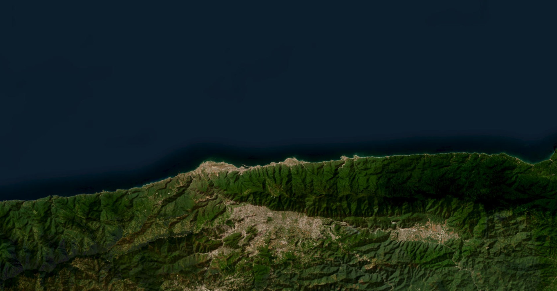
Exposure is the operational figure DisasterAWARE attaches to every event. The initial affected-area model for the M7.8 enclosed approximately 10.9 million people, 2.64 million households, and $59.7 billion in infrastructure replacement value. These are point-in-time estimates the platform refines as ground reports arrive from PHIVOLCS and the National Disaster Risk Reduction and Management Council; by Sunday afternoon UTC the on-the-ground picture was still resolving, but no large-scale structural collapses had been reported, consistent with the intermediate-depth ground-motion expectation. The asymmetry to watch is the Mindanao coastal lowland population: General Santos City, Davao City, and the Sarangani Province coast sit in the immediate shaking footprint with combined populations in the millions.
Twelve minutes after the Mindanao main shock, the Pacific Tsunami Warning Center in Ewa Beach, Hawaii, issued its first regional advisory message for the Pacific basin. Twelve minutes is the operational target for a M7+ Pacific-basin earthquake: long enough to confirm magnitude and location from at least three deep-ocean seismometers, short enough that the message reaches civil-defense authorities before the leading tsunami wave fronts could reach coastal populations even at the nearest end of the basin. The advisory chain that followed unfolded across four warning centers over the next eighteen hours, and the entire sequence has now stood down.
The PTWC's regional Pacific Tsunami Information Statement was the first published — "Tsunami Message Number 6" by the time we transcribed the final version, indicating five successive update messages refining the threat assessment as deep-ocean buoy data arrived. The concluding language is unambiguous: "The tsunami threat from this earthquake has now passed, with only minor sea level fluctuations expected. Government agencies in impacted coastal areas are advised to monitor conditions and assess when it is safe to resume normal activities." That is exactly the language a Pacific-basin civil-defense officer in Indonesia, Papua New Guinea, or the Solomon Islands needs at hour eighteen: confirmation that the wave heights observed at the closest buoys do not warrant continued evacuation.
The Hawaiian Islands advisory was issued by PTWC for state-level use. The determination — "no tsunami threat to Hawaii" — was made at the second update, after deep-ocean buoys between the Philippines and Hawaii returned readings inconsistent with a tsunamigenic event. The U.S. West Coast / British Columbia / Alaska statement came from the U.S. National Tsunami Warning Center in Palmer, Alaska, with the same conclusion phrased for the U.S. emergency-management community: "There is no tsunami danger for the U.S. West Coast, British Columbia, or Alaska. Some areas may experience non-damaging sea level changes."
The Cuba M6.1 event eighteen hours later triggered a fourth, separate statement — this one from the NTWC for the U.S. East Coast and Gulf. Magnitude-6.1 is, in normal circumstances, below the threshold where most tsunami centers issue any statement at all. The NTWC issued one anyway, against the historical-record context that the 1755 Lisbon earthquake (M~8.5) generated a Caribbean-basin tsunami and that the Cuban offshore fault system is poorly characterized. The conclusion: "There is no tsunami danger for the U.S. east coast, the Gulf of America states, or eastern Canada. Based on the earthquake information and historical tsunami records, no tsunami is expected to be generated."
Across all four advisories, the observed maximum sea-level change was minor and non-damaging. Nothing struck. That is not a system failure — it is the system working as designed. The asymmetry is the point: the cost of issuing a precautionary advisory that proves unnecessary is several hours of coastal-resort closures and disrupted commercial activity. The cost of missing an actual tsunami is measured in lives. Every tsunami warning center on Earth is calibrated, deliberately, to the second of those costs. This week is what that calibration looks like in operation.
The Cuba earthquake was the week's smaller seismic story but the one closer to home for a U.S. audience. At 18:00:27 UTC on June 8, USGS NEIC reported a magnitude-6.1 earthquake at 118 km WNW of Mantua, on Cuba's western Pinar del Río province coast. Depth: 26 km. Coordinates: 22.79°N, 85.15°W — offshore in the Gulf of Mexico, just inside the western edge of the North American–Caribbean plate boundary fault system.
Two technical details explain the "felt across Florida" reporting. The first is depth. At 26 km, the Cuba event is the textbook shallow earthquake — most of its seismic energy arrives at the surface as relatively unattenuated S-waves with strong horizontal ground motion. A M6.1 at 26 km depth will produce stronger felt shaking at the surface than a M7.0 at 100 km depth in many cases. The second is path. The Gulf of Mexico transmits seismic waves efficiently through its sedimentary basin, and the South Florida limestone basement amplifies long-period ground motion. Together, those conditions mean a M6.1 on the Cuban offshore is almost guaranteed to be felt as far north as the I-4 corridor.
Initial canvases from Florida emergency-management offices and the U.S. Geological Survey "Did You Feel It?" portal showed thousands of felt reports concentrated in Miami-Dade, Broward, and Collier counties, with scattered reports as far north as Tampa and Tallahassee. As of the close of the brief window, no significant structural damage had been reported in Florida or Cuba, and the U.S. NTWC's tsunami information statement had been concluded with no further messages anticipated.
For long-term seismic-risk context, the Cuba M6.1 sits within the Septentrional-Oriente strike-slip system — the same boundary that produced the 2010 Haiti M7.0 catastrophe 1,200 km to the southeast. The fault segment that ruptured this week is poorly instrumented relative to its potential, and the M6.1 is a useful prompt to highlight the broader Caribbean-basin seismic-hazard picture: a population concentration of more than 40 million people sits inside the affected-area models for any future M7+ event on this system.
The Mindanao and Cuba events dominate this week's seismic story, but six other M5.5+ earthquakes in the same window reinforce that the planet's seismic background rate is never zero. None of these are related to either main shock; together they sketch the ordinary geography of Earth's plate boundaries.
The Kuril Trench produced a doublet at Severo-Kuril'sk, Russia: a M6.1 at 35 km depth on June 7 at 10:42 UTC, followed by a M5.5 at 10 km depth four hours later, both ~140 km SE of the island. The Kuril Trench is the same Pacific-Plate subduction system that produced the 2006 M8.3 and the 2007 M8.1 doublet, and the offshore M6+ rate there averages once every two to three weeks. The June 7 doublet sits squarely within normal.
Bhutan registered a M5.6 at 15 km WNW of Punākha at 10 km depth — Himalayan-front thrusting, the same convergent system that produces the great Nepal earthquakes. Easter Island produced a M5.8 on the East Pacific Rise oceanic-ridge system at 10 km depth. Two earthquakes registered on the southern Mid-Atlantic Ridge (M5.5 and M5.4 at the same epicenter, four hours apart, at 10 km depth) — the slowest of the major mid-ocean ridges, with an M5+ background rate of roughly two events per month. A M5.4 197 km SSE of Isangel, Vanuatu, rounds out the global oceanic-and-arc background.
None of these will appear in a weekly news cycle. They appear in the brief because not seeing them would be misleading — the planet is always shaking, somewhere, at the M5.5+ rate.
Eighty-four active wildfire events are running concurrently across both hemispheres in this week's data — the second-largest hazard category after earthquakes, and the operational signal that the Northern Hemisphere fire season has formally begun.
The Northern Hemisphere cluster spans four distinct regions. Russia carries the largest national share by event count, with active wildfires in Krasnoyarsk Krai (Baykitskiy, Eniseyskiy, and Bratskiy rayons), Irkutsk Oblast, Khanty-Mansiy Autonomous Okrug (Surgutskiy rayon), and Tambov Oblast (Petrovskiy rayon). The Baykitskiy Rayon fire in Krasnoyarsk was assessed as extremely severe in DisasterAWARE's most recent update — 180 people, 73 households, and $497,000 of infrastructure inside the affected-area model, with a forested-near-communities ignition signature and a "needs attention right away" severity assessment. Ukraine adds a war-overlay fire cluster — active wildfires across Donetsk, Luhansk, Kharkiv, and Kherson — where front-line combat activity and the dry early-summer landscape are interacting to produce ignition counts well above the regional climatology. Canada has registered active fires across northern Manitoba and Saskatchewan; the United States has fires in Texas (Borden, Garza, Scurry), North Dakota (Ramsey, Towner), Florida (Manatee), and parts of the Great Plains.
The Southern Hemisphere counter-cluster is in full dry season. Australia carries the largest national share — Northern Territory dominates (Tiwi Islands, Victoria-Daly, Roper Gulf, West Arnhem), with additional events in Queensland (Lockyer Valley, assessed as severe and rapidly expanding) and Western Australia (Ashburton). Angola has two large clusters (Malanje / Lunda Norte, Moxico). The Democratic Republic of the Congo registered new ignitions in Kasaï and Haut-Katanga during the brief window. Chile recorded a wildfire in the Araucanía region's Cautín province.
The provenance line bears repeating from prior briefs: each of these events represents a real combustion heat signature observed from a NASA satellite — not a forecast, not a watch, not a model of what could burn. Ground corroboration follows in the days after detection; the satellite layer is the leading edge. Fire-weather watches and pre-fire alerts (which we do track separately) are not included in these 84 events.
Eight active flood events are tracked in the brief window, with the strongest geographic signal across northern South America and Central America. Floods are running in Colombia (western), Brazil (multiple states), Guatemala, and across Central America regionally — a cluster consistent with the onset of the wet season transition in the Intertropical Convergence Zone. We note these as confirmed flood events, distinct from the 53 NASA Global Flood Model forecasts removed by the occurrence filter and tracked separately in the supporting data.
Three outlier flood events round out the global picture: Veliko Tarnovo in Bulgaria, Tichá in Czechia, and the Upper Euphrates Basin in Syria. The Bulgarian and Czech events fit the seasonal pattern of late-spring runoff from the Carpathian and Balkan systems; the Syrian event is anomalous and warrants further reporting attention given the limited civil-protection capacity in the region.
The always-on tail of the global hazard set runs the same as it did last week, with a few items worth noting. Sixteen active volcanoes carry the Pacific-Rim seismotectonic backdrop against which this week's Mindanao sequence sits — Fuego in Guatemala, Semeru in Indonesia, Mayon in the Philippines all in continuing eruptive phases, plus thirteen others spanning the Ring of Fire from Japan to Chile. None of the sixteen are interacting causally with the Mindanao earthquake; the geographic correlation is the same plate-boundary system, not a triggered response.
Twenty COMBAT events continued across multiple theatres during the brief window. Seven biomedical events remain active, including disease-outbreak tracking that we carry over from prior briefs. Two civil-unrest events were recorded. Five storm events and two high-wind events round out the weather-and-impact tally.
Thirteen manmade hazard events (industrial accidents, transportation incidents) and four accidents were tracked separately — the tail-end "everything else" categories that don't anchor a weekly theme but matter for operational subscribers monitoring specific corporate or critical-infrastructure footprints.
This section is forecast context, not confirmed events. The DisasterAWARE occurrence filter removed 6,982 formal agency warnings, advisories, watches, and forecasts from the actual-event sets above; twenty-two of those are EXTREMETEMPERATURE warnings worth surfacing here as forward-looking narrative. None of these are tsunami impacts, earthquake aftershocks, or wildfire perimeters — they are meteorological-agency forecasts of upcoming heat (and, in one anomalous case, cold) events.
The notable items: the Hong Kong Observatory has issued an extreme-heat warning for the territory, consistent with the broader Southeast Asia early-summer heat-dome pattern that produced the "Heat Behind the Fire" narrative in the May 27 brief. Ecuador's national meteorological service INAMHI has issued heat warnings across multiple regions — Litoral / Interandina / Amazon nationally, and a separate Esmeraldas / Los Ríos / Pichincha / Imbabura warning — a continuing signal as the equatorial heat-belt expands. An unusual late-season frost warning has been issued east of Xuanhua, Hebei, China — a reminder that the early-summer agricultural calendar in northern China still has cold-snap risk.
On the live map, these forecast items are rendered on a separate hollow-dashed amber layer that is OFF by default, with tooltips prefixed [FORECAST/WARNING — NOT A CONFIRMED EVENT]. Toggle the layer on to see the geographic distribution; the visual distinction is intentional and not an oversight.
The Mindanao aftershock decay. Omori's law predicts the aftershock rate will fall logarithmically over the coming days, with another five to eight M5+ events likely per day for the next week. The number to watch is whether any single aftershock approaches or exceeds M7.0 — a M7+ aftershock would change the operational picture substantially and is statistically unlikely but not impossible.
Cuban offshore seismicity. Whether the M6.1 was a one-off or the leading edge of a renewed Septentrional-Oriente fault activation will become clear over the next two to three weeks. The base rate for the Cuban offshore is one M6+ event per several years; two within a month would warrant a substantially elevated Caribbean-basin seismic-hazard advisory.
Northern Hemisphere fire-belt expansion. Eighty-four wildfires today is the floor, not the ceiling, for the June-through-September window. We will be watching the Russia-Siberia and Canada-British Columbia / Alberta perimeters most closely; both have been the largest fire-emissions producers globally in recent years and both are entering peak-burn season.
Hong Kong and Southeast Asia heat. If the forecast heat warnings resolve into confirmed events over the next week, the brief narrative shifts toward a heat-led story. Today they are forecasts. By next Sunday they may not be.
The operational picture you have just read is what DisasterAWARE delivers to enterprise subscribers as a continuously updated, single live view. Every USGS NEIC reading, every ASEAN AEIC bulletin, every PTWC and NTWC tsunami advisory, every NASA FIRMS thermal detection, every PHIVOLCS volcano update, every meteorological-agency heat warning lands on the same map, attributed to the same population and asset exposure model, with the same lifecycle tracking that keeps a main shock and its twenty-four aftershocks linked as one continuing sequence rather than twenty-five disconnected alerts.
The Mindanao M7.8 is exactly the kind of event our subscribers' duty officers rely on us for. Within minutes, the platform attributes the event to the correct fault system, calculates the affected-area exposure, links the PTWC advisory chain to the parent seismic event, surfaces the relevant aftershock sequence as it develops, and tags the relevant operational footprints (port facilities, supply-chain nodes, deployed personnel) against the shaking intensity contours. A duty officer does not assemble this picture from twenty source feeds at 2 a.m.; the picture is already assembled, and the operational decision can be made on the fly.
That is the work behind the brief. Every week.
Data sources: USGS NEIC, ASEAN AEIC, PHIVOLCS, Pacific Tsunami Warning Center, U.S. National Tsunami Warning Center, NASA FIRMS, DisasterAWARE platform. Period: 2026-05-29 to 2026-06-08 UTC. Forecast / agency-warning context (e.g. extreme-heat warnings) is labeled and tracked separately and is not included in confirmed-event counts.


-min.png)


.png)


.png)


Decision-ready intelligence for understanding what's happening, what is impacted, and what to do next. Global hazard, severe weather, catastrophe, and physical risk intelligence trusted by governments, enterprises, insurers, humanitarian organizations, and technology platforms worldwide.
Request DemoContact Us