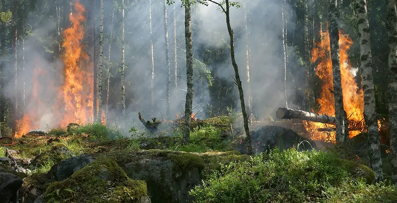
Wildfires are among the most destructive natural hazards, causing billions of dollars in damages and putting lives, property, and critical infrastructure at risk. In recent years, their frequency and intensity have only increased. For example, AccuWeather estimates that the 2025 Los Angeles wildfires alone caused over $250 billion in damages—an alarming reminder of the devastating impact these events can have on communities and economies.
That’s why real-time wildfire monitoring is more important than ever—and why DisasterAWARE plays a vital role in helping organizations, governments, and businesses stay ahead of the threat.
DisasterAWARE delivers global, real-time wildfire monitoring using a patented approach to detect and assess wildfire activity as it unfolds. Our system leverages the latest satellite data from NOAA, providing a reliable, near real-time view of wildfire hotspots and spread. Whether you’re monitoring active fires, preparing for evacuation planning, or protecting critical assets, DisasterAWARE gives you the trusted intelligence you need to make fast, informed decisions.
DisasterAWARE makes it easy to monitor wildfires as they develop—whether you’re tracking a specific event or maintaining situational awareness across a region.You can view wildfire hazards directly on the interactive map or select them from the hazards list in the left-hand panel. Clicking on a wildfire opens the Hazard Inspector, which provides detailed, up-to-date information about the event.
At the top of the Hazard Inspector is a list of automatically generated reports, known as products, that are updated with each new satellite observation. These reports may also include additional insights curated by our internal disaster response team—especially when a wildfire escalates into a broader disaster affecting people, infrastructure, or supply chains.
The automated reports, called Situational Awareness Reports, are delivered as shareable PDFs designed for quick understanding and distribution within your organization. These are especially helpful for analysts, emergency planners, and decision-makers who rely on timely, actionable information.
A clear summary of the wildfire’s current status and potential impacts
Maps showing the fire’s extent and areas of active burning

Plotted fire radiative potential points, which indicate both the location and intensity of active fires
This combination of automated updates and expert-curated information ensures that your team stays informed with the most relevant data—ready to support decisions that matter.
Conditions are possible for limited or minor impacts to the population.
Conditions are possible for limited or minor impacts to the population. Exercise Caution.
Conditions are possible for adverse or significant impacts to the population. Monitor closely and be prepared to act.
Adverse or significant impacts to the population are imminent or occurring. Act now.
For wildfires, severity is determined using a combination of fire size, intensity, and proximity to populated areas. Every wildfire hazard in DisasterAWARE must meet a minimum threshold—based on either Fire Radiative Power (FRP) or fire size—to be created, and will start at the Information level.
When FRP scale values reach between 10–11, representing 22–100 gigawatts
When FRP scale exceeds 11 and surpasses 100 gigawatts
There are three or more active hotspots located within or near Wildland-Urban Interface (WUI) zones or urban areas
This tiered severity logic ensures that DisasterAWARE not only reflects the physical characteristics of the wildfire but also accounts for the risk it poses to people, infrastructure, and communities.
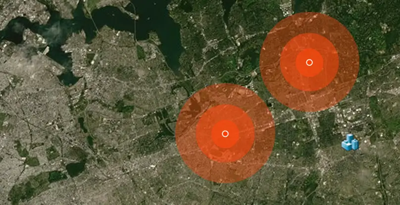
DisasterAWARE uses two key geographic boundaries to help users understand and respond to wildfire threats: Exposure Areas and Notification Areas.

The Exposure Area represents the actual burn area of the wildfire. This is the estimated perimeter of the fire and defines the total area affected by the event.
The Notification Area is used to determine which users should be alerted. It’s created by taking the current wildfire perimeter and applying a 2,500-meter buffer around it. This expanded area ensures that nearby communities and infrastructure are included in alerts, even if they’re not yet directly impacted by the fire.
When a user’s Area of Interest intersects with a wildfire’s Notification Area—and the severity level matches their alert preferences—DisasterAWARE automatically sends a notification. This ensures that decision-makers and responders receive timely updates tailored to the areas they care about most.
By distinguishing between exposure and notification areas, DisasterAWARE supports both accurate situational awareness and proactive alerting—helping users take informed action before the wildfire spreads further.
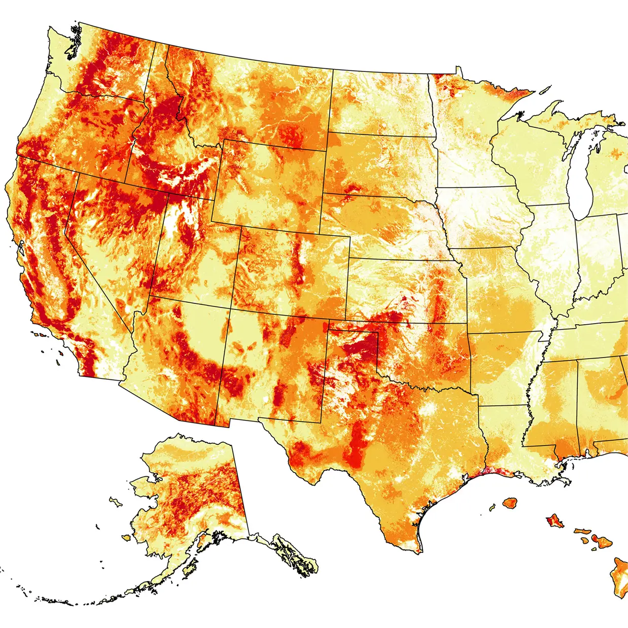
In addition to real-time wildfire hazards, DisasterAWARE provides a rich set of supporting map layers that offer valuable context when evaluating wildfire risk. These layers can be viewed alongside your own data—such as critical assets, facilities, and infrastructure—to better understand how a wildfire may affect your operations.You’ll find these layers in the Layers Panel, under the Hazards and Events folder, within the Wildfire subfolder.
These layers help users assess conditions on the ground, identify what’s at risk, and anticipate how a wildfire could evolve. Whether you’re tracking fires in remote regions or near populated areas, these datasets provide the essential information needed to support decision-making and risk mitigation.
DisasterAWARE includes powerful Asset Protection tools that help organizations monitor how hazards—such as wildfires—affect the people, places, and infrastructure they care about most.
Once loaded, assets can be viewed in two ways: through the Notification Panel, or by enabling their associated map service layer under the User folder in the Layers Panel.Assets can be user-owned or shared at the organization level. Organizations with multiple teams can also set up Sub-Organizations, each with their own asset classes and notification rules—providing flexibility in how asset data is managed and accessed across departments.
For each asset class, users can define non-user contacts—such as building managers or emergency coordinators—who should receive notifications when a hazard threatens specific locations. These contacts receive email alerts with detailed hazard information, ensuring they stay informed even if they don’t actively use the platform.
These features help organizations stay ahead of emerging threats, understand the geographic relationship between hazards and their assets, and quantify their total exposure—supporting faster, more informed decisions during critical moments.
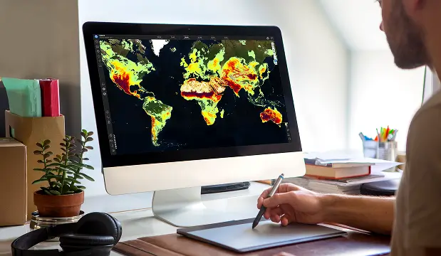
For organizations that prefer to work directly with data, DisasterAWARE’s Data as a Service (DaaS) offers seamless access to global wildfire hazard information through a suite of REST APIs.
In addition to real-time data access, DisasterAWARE also supports event-driven updates for customers who prefer to receive hazard notifications as soon as changes occur. These updates can be integrated directly into internal systems, dashboards, or applications—keeping teams informed without the need to constantly poll for new data.
With this capability, DisasterAWARE becomes a powerful back-end data service for polowering decision-support tools, risk analysis platforms, or custom emergency management solutions. It provides a comprehensive, global view of wildfire activity, ready to be integrated into the systems you already rely on.
Decision-ready intelligence for understanding what's happening, what is impacted, and what to do next. Global hazard, severe weather, catastrophe, and physical risk intelligence trusted by governments, enterprises, insurers, humanitarian organizations, and technology platforms worldwide.
Request DemoContact Us