

For the US property and casualty insurance industry, the week of April 20–27, 2026 was a claims week. Tens of thousands of policyholders across at least fifteen states will file claims for hail-damaged roofs, totaled vehicles, broken siding, downed trees, destroyed outbuildings, and — in the worst-hit communities — leveled homes and commercial structures. The driver was a single, sustained severe convective storm (SCS) pattern that produced 157 tornado warnings, 784 severe thunderstorm warnings, 78 confirmed tornadoes, 733 hail reports, and 508 damaging-wind reports across a continental-scale footprint stretching from the Canadian border to the Gulf Coast and from California's Central Valley to the Ohio Valley. This is what the most expensive natural-catastrophe peril in the United States actually looks like in a single week — not a hurricane on a coastline, but claim activity everywhere at once.
The term severe convective storm doesn't come from the National Weather Service — it comes from the insurance and reinsurance industry. SCS is the umbrella label for any thunderstorm that produces at least one of three sub-perils:
Why the industry needs its own term: because hurricanes and wildfires get the headlines, but on the reinsurance scoreboard, SCS has been the single largest driver of US insured natural-catastrophe losses for three consecutive years. According to Aon's 2026 Climate and Catastrophe Insight, severe convective storms are now the costliest insured peril in the United States since 2000.
Munich Re describes US SCS as a peril that now “causes losses in the mid-double-digit billions of dollars every year — as much as a very severe hurricane.” The April 20–27 outbreak is the kind of week that builds those annual totals.
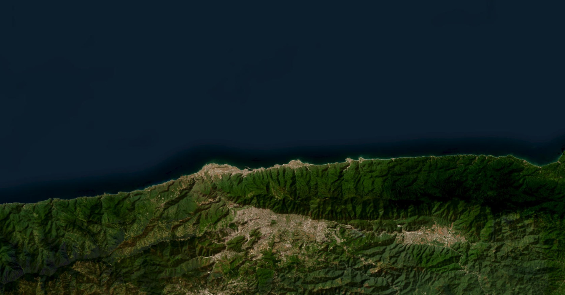
The map below layers every tornado warning, severe thunderstorm warning, hail swath, damage survey path, and ground report from April 20–27, 2026. The thing to notice first is not any single feature — it is how much of the country is covered. Zoom out and the warnings, swaths, and reports tile across roughly 15 states and a third of the contiguous US land area.
Showing every layer simultaneously would overwhelm the view. The default-on layers (NWS damage survey paths, ground-truth tornado/hail/wind reports, and MESH radar hail swaths at 1.5″ and larger) already paint a striking picture. The full density of severe weather across the country only becomes visible once the default-off layers are turned on. Use the layer control in the upper-right of the map to enable any of the following — each one tells a different part of the story for insurance and exposure analysis:
The full layer set, taken together, represents over 9,000 individual data features for a single week of severe weather across the United States.
Map data: NWS Weather Forecast Offices, Storm Prediction Center local storm reports, NWS Damage Assessment Toolkit, and NOAA MRMS radar-derived MESH hail swaths. Visualization powered by DisasterAWARE Enterprise.
Looking at the map is one thing. Turning that data into a claim-ready operational picture is something else — and it is precisely what the DisasterAWARE Enterprise platform does for property and casualty insurers, reinsurers, and risk managers in real time as severe weather is unfolding:
For carriers not currently working with DisasterAWARE, this article and its underlying data are a representative example of the operational picture available continuously, in real time, and integrated against your own book of business.
Every SCS outbreak produces at least one event the news will lead with — this week, it was a violent EF4 tornado that struck Enid, Oklahoma on the evening of April 23, the first EF4 in the United States in 2026. That event matters and is covered below. But it is not the story of this week for the insurance industry. The story is the footprint.
A Category 3 hurricane making landfall in Florida is a catastrophic event for one or two states. A multi-day SCS pattern like this one places policies, fleet vehicles, distribution centers, dealerships, solar arrays, and crops across roughly half the population of the contiguous US in proximity to active severe weather over the course of a single week. Even if only a small fraction of that exposure ultimately produces a claim, the count of claims — auto hail, residential roofing, commercial property, solar, agriculture, signage, fencing, and outbuildings — runs into the tens of thousands per event of this magnitude.
That is the structural reason SCS now produces $50-billion+ insured loss years in the United States, and why reinsurers price the peril differently than they did a decade ago. SCS is not won or lost on a single tornado. It is won or lost on the breadth of the cumulative footprint.
| Region | NWS forecast offices involved | Dominant sub-perils | Notes |
|---|---|---|---|
| Northern Plains (MT, ND, SD, MN) | BIS, ABR, FGF, MPX | Damaging wind, severe hail | 70+ mph wind gusts widespread Apr 22–23; mesonet stations Wishek ND, Plentywood MT, Medicine Lake MT all measured 70+ mph |
| Central Plains (IA, NE, KS, MO) | DMX, DVN, OAX, ICT, TOP, EAX, SGF | Tornadoes, large hail, damaging wind | Bulk of tornado activity Apr 23–24; numerous EF0–EF1 surveys |
| Southern Plains (OK, TX) | OUN, TSA, FWD, AMA, LUB | All three — including the EF4 | Largest concentration of significant hail; DFW metroplex hit Apr 26 |
| Mid-South (AR, LA, MS) | LZK, SHV, JAN, LIX | Tornadoes, very large hail | 4.5″ hail Alpine AR; multi-day tornado outbreak across Mississippi |
| Mid-Mississippi / Ohio Valley (IL, IN, KY) | LSX, ILX, IND | Damaging wind, hail | Final pulse Apr 27 across St. Louis and central Illinois |
| California Central Valley (separate, earlier-week setup) | HNX | Brief tornadoes (rare for region), hail | Three California tornadoes near Fresno and Atwater Apr 21–22 |
That last row is worth pausing on: California had confirmed EF1 tornadoes in the same week as Mississippi, Oklahoma, Iowa, and Texas. Severe convective weather respects no regional boundaries; an exposure portfolio with assets across the central US, the Mid-South, and the West Coast was active for SCS losses simultaneously.
Hurricanes are low-frequency, high-severity events concentrated along the coasts. Wildfires cluster in the West. Severe convective storms are different — and worse for insurers in five compounding ways:
The April 20–27 outbreak is the kind of week the reinsurance industry now routinely models as a billion-dollar+ insured loss occurrence, and the kind of week that, repeated four to six times in a season, builds the $50-billion-plus annual totals that have defined 2023, 2024, and 2025.
The week began quietly. April 20 produced a single severe thunderstorm warning nationwide. By the night of April 23, a deepening upper-level trough over the Rockies was driving a sharp surface low into the central Plains, drawing Gulf moisture northward against a stalled boundary. The result was a textbook five-day SCS regime that tracked from the Northern Plains south to the Gulf Coast.
| Date | TOR Warns | SVR Warns | Tornado LSRs | Hail LSRs | Wind LSRs | Headline WFOs |
|---|---|---|---|---|---|---|
| Apr 20 | 0 | 1 | 0 | 0 | 0 | — |
| Apr 21 | 2 | 15 | 2 | 13 | 2 | HNX (Hanford CA) |
| Apr 22 | 1 | 20 | 5 | 45 | 56 | Northern Plains |
| Apr 23 | 20 | 108 | 17 | 123 | 72 | DMX, EAX, ICT, OAX, OUN, TOP |
| Apr 24 | 42 | 156 | 22 | 91 | 170 | DMX, DVN, EAX, ICT, IND, OUN, SGF, TOP, TSA |
| Apr 25 | 22 | 134 | 15 | 96 | 94 | FWD, JAN, LIX, LZK, OUN, SHV |
| Apr 26 | 33 | 178 | 11 | 223 | 71 | EAX, FWD, ICT, OUN, SGF, SHV, TOP |
| Apr 27 | 35 | 169 | 6 | 142 | 43 | EAX, ICT, ILX, LSX, OUN, SGF |
Two numbers stand out. April 24 produced 42 tornado warnings in a single operational day — the most intense tornado-warning day of 2026 so far. April 26 produced 223 hail reports — the largest single-day ground-truth hail total of the year, and a clear signal of how violent the cold-pool/storm-mode evolution had become as the system rotated south into Texas and Arkansas.
April 23 is the day the footprint became continental. 20 tornado warnings, 108 severe thunderstorm warnings, and ground reports from at least nine states — Iowa, Nebraska, Kansas, Missouri, Oklahoma, North Dakota, South Dakota, Montana, and Minnesota — were filed before midnight. Damaging straight-line winds 70+ mph were measured across the Northern Plains from mesonet stations at Wishek ND, Akaska SD, Plentywood MT, and Medicine Lake MT — the same day a violent tornado was carving through north-central Oklahoma.
That tornado was the headline event: a violent strike on Enid, Oklahoma (Garfield County, ~85 miles north of Oklahoma City). Norman WFO (OUN) damage assessment teams later rated the tornado EF4 with peak winds estimated at 170 mph, carving a roughly 9.5-mile path through residential neighborhoods and rural land north and northeast of the city.
This is the first EF4 tornado in the United States in 2026, and the first EF4 tornado on record in Garfield County, Oklahoma since April 26, 1991 — almost exactly 35 years to the day. It is also Oklahoma's first April tornado emergency on record. Governor Kevin Stitt issued Executive Order 2026-17, declaring a state of emergency for Garfield and Kay counties, mobilizing state assistance and unlocking federal coordination channels.
The Enid tornado is significant beyond the immediate damage — a single EF4 strike on a city is a multi-hundred-million-dollar insured loss event on its own. But it is one event inside a continent-wide pattern. While Enid was being surveyed, hail damage was being filed in Kansas (3.5″ hail at Mayfield, 4.0″ hail near Marion), tornadoes were being confirmed by Omaha (OAX) damage surveys in Iowa, and 70+ mph straight-line winds were tearing through the Dakotas and eastern Montana. Insurance claims being generated on April 23 alone spanned nine states and at least four distinct sub-peril categories.
April 24 was the most prolific severe weather day of 2026 to date: 42 tornado warnings, 156 severe thunderstorm warnings, 22 confirmed tornadoes, 91 hail reports, and 170 wind reports — the highest single-day wind-report count of the week. The storm corridor stretched across roughly 1,000 miles north-to-south, with simultaneous severe weather operations in nine NWS county warning areas — Des Moines (DMX) and Davenport (DVN) in Iowa, Indianapolis (IND) in central Indiana, Topeka (TOP) and Wichita (ICT) in Kansas, Kansas City (EAX) and Springfield (SGF) in Missouri, and Tulsa (TSA) and Norman (OUN) in Oklahoma. At various points in the day, all nine WFOs had active tornado warnings out at the same time.
Notable confirmed tornadoes from that day include:
April 24 also produced 3.75-inch (grapefruit-sized) hail near Braman, OK, alongside scattered 1.5–3.0″ hail reports filed simultaneously across Iowa, Kansas, Missouri, and Oklahoma. The cumulative hail footprint for the day alone — measured by MRMS swaths — covered an area larger than the state of Indiana.
By April 25, the surface low had pushed southeast and the supercell environment shifted into the Lower Mississippi Valley. Jackson MS (JAN), Slidell/New Orleans (LIX), Shreveport (SHV), and Little Rock (LZK) issued the bulk of the day's tornado warnings — 22 in total — and Jackson WFO surveys ultimately confirmed at least seven EF1 tornadoes across central and southern Mississippi.
Among them:
The day also marked the appearance of the largest hail report of the entire week — a 4.5-inch (softball-sized) hailstone at Alpine, Arkansas — measured against a ruler and confirmed via photo by NWS Little Rock (LZK). At 4.5″, a single hailstone has roughly the kinetic energy of a falling brick.
April 26 produced the highest hail report count of any single day in 2026: 223 ground-truth hail reports, alongside 178 severe thunderstorm warnings and 11 confirmed tornadoes. Crucially, those 223 reports were not concentrated in one corridor — they were distributed across at least eight states (Texas, Oklahoma, Arkansas, Kansas, Missouri, Louisiana, Mississippi, and southern Illinois), with significant clusters in north Texas, central Arkansas, and eastern Kansas / western Missouri all active simultaneously. For property carriers writing across the southern US, April 26 was a single-day, multi-state cat-loss event in its own right.
The Dallas–Fort Worth metroplex took the most concentrated hit:
For carriers writing personal lines and auto in the DFW metroplex, April 26 is the kind of day that drives quarterly catastrophe loads — but the day's footprint extended far beyond DFW. The Dallas hail swath, the Arkansas hail swath, and the Kansas/Missouri hail swath were all the same day. A reinsurance program with a 24-hour hours-clause definition would treat them as a single event; a program with a 72-hour clause would aggregate them with the April 25 and April 27 hail across the same region. Either way, exposure across half a dozen states was being drawn down simultaneously.
The system's final pulse on April 27 brought another 35 tornado warnings, 169 severe thunderstorm warnings, and 142 hail reports across the Mid-Mississippi Valley — Lincoln IL (ILX), St. Louis (LSX), Springfield-MO (SGF), Wichita (ICT), Norman (OUN), and Kansas City (EAX). Six tornadoes were confirmed, with most producing minor tree and structural damage. Damage assessment teams will continue to publish surveys for days to come; the final tornado count from this week is expected to climb above 90 once all ground surveys are complete.
What makes the April 23–27 outbreak particularly notable for the insurance industry is that it produced significant losses in all three SCS sub-perils:
| Sub-Peril | Reports | Headline Event | Insurance Significance |
|---|---|---|---|
| Tornadoes | 78 confirmed touchdowns; 33 NWS damage paths | EF4 Enid, OK (170 mph) | Violent tornadoes deliver concentrated, high-severity losses; commercial structures and large residential developments |
| Hail | 733 ground reports; 5,400+ MRMS radar swaths | 4.5″ Alpine, AR | Hail is the single largest loss driver across personal lines and auto in any modern SCS event |
| Damaging wind | 508 reports | 107 mph Vance AFB, OK | Straight-line wind / derecho-style events drive widespread but lower-severity claims; fence, siding, soffit, and roof-edge damage |
A typical “billion-dollar SCS event” might lean heavily on one of these — say, a single hail swath through DFW — but the April 23–27 outbreak hit hard across all three categories simultaneously, across a 1,500-mile geographic footprint. Events of this profile are exactly what reinsurers describe when they say SCS now structurally rivals hurricanes as a source of US insured loss.
The atmospheric setup for April 23–27 was forecast well in advance. The Storm Prediction Center had highlighted an enhanced severe weather risk corridor across the central US for several days, and Day 4–7 outlooks accurately captured the overall threat envelope. But knowing that severe weather is likely somewhere across a five-state region for five days is not the same as knowing which assets are in the path of a specific supercell right now.
That gap — between strategic outlook and tactical decision-making — is where real-time SCS intelligence does its work for insurers, emergency managers, fleet operators, and asset-heavy enterprises:
This week's outbreak generated more than 940 NWS warnings, 1,975+ ground reports, and 524 damage survey points — the kind of operational data volume that simply cannot be tracked manually across a multi-day, multi-state event.
The DisasterAWARE Enterprise platform monitored the April 20–27 SCS pattern continuously across all 25+ NWS forecast offices that issued warnings, providing:
The map and the underlying dataset represent the same operational picture available to DisasterAWARE Enterprise customers in real time during the event itself, refreshed continuously as new data arrived from NOAA, the Storm Prediction Center, and individual forecast offices.
The instinct in covering severe weather is to lead with the worst event — the EF4, the city in the path, the single dramatic image. That instinct misses what makes SCS such a structurally expensive peril. Hurricanes are the peril of concentration. SCS is the peril of breadth.
A Category 3 hurricane affects perhaps two states' worth of insured exposure. The April 20–27 SCS outbreak put exposure in fifteen states in proximity to severe weather, generated 940+ warning polygons, painted radar hail signatures across an area larger than several northeastern states combined, and triggered ground reports from Hanford, California to Slidell, Louisiana to Indianapolis, Indiana. A single mid-tier carrier writing personal lines across Texas, Oklahoma, Arkansas, Kansas, Missouri, Iowa, Mississippi, and Louisiana could plausibly see claim activity from this single weekly pattern in every one of those states simultaneously.
In the broader context of the SCS loss curve, a week of this profile is closer to normal for a peak-season pattern than to anomalous. Multi-day SCS regimes producing 70+ tornadoes, 700+ hail reports, and 500+ wind reports across a third of the country have occurred multiple times per year in each of the last three years. They are the building blocks of the $50-billion-plus annual US insured loss totals that have made SCS the most expensive natural-catastrophe peril of the 21st century — totals built not from one $30B event but from dozens of $1–5B multi-state weeks, each one quietly adding to the annual bill.
What changes year over year is not whether such weeks happen — it is how much exposure sits inside the corridor when they do. Population growth across the SCS belt, rising insured values, the proliferation of rooftop solar, the steady aging of US residential roofing stock, and the migration of distribution and logistics infrastructure into Texas, Oklahoma, and Tennessee all push expected losses higher for the same atmospheric setup. The footprint is not getting wider every year — it doesn't need to. The exposure inside the footprint is what is growing.
For risk managers, insurers, reinsurers, fleet operators, and asset-heavy enterprises with operations across the central US, the April 20–27 outbreak is both a reminder and a benchmark: a week of severe weather covering a third of the country, generating tens of thousands of potential claims across more than a dozen states, and producing — by historical SCS standards — what will likely not even rank as the costliest week of the 2026 season.
The 2026 SCS season has just begun.
Data sources: NWS Weather Forecast Offices (OUN, ICT, TOP, EAX, SGF, JAN, LIX, SHV, LZK, FWD, DMX, OAX, TSA, IND, ILX, LSX, HNX, and others), Storm Prediction Center, NWS Damage Assessment Toolkit, NOAA MRMS radar mosaics. Industry context: Aon Climate and Catastrophe Insight 2026, Munich Re NatCat Service, Swiss Re Institute sigma. Damage and casualty figures for the Enid, OK EF4 tornado are preliminary as of April 27, 2026 and subject to revision as NWS Norman completes final damage surveys. Visualization powered by DisasterAWARE Enterprise.


-min.png)


.png)


.png)


Decision-ready intelligence for understanding what's happening, what is impacted, and what to do next. Global hazard, severe weather, catastrophe, and physical risk intelligence trusted by governments, enterprises, insurers, humanitarian organizations, and technology platforms worldwide.
Request DemoContact Us