Two weeks into the Northern Hemisphere fire season, the picture has not narrowed — it has widened. Across a 10-day window, DisasterAWARE detected and named 820 wildfire events spanning six continents: peak dry season in Mexico and Central America, a coherent fire front across West Africa, boreal spring fires along the Russia–Ukraine border, a wide Southeast and California signal across the United States, and still-producing late-autumn perimeters in Australia and Southern Africa. Of those 820 events, 212 are at WARNING severity right now — fires close enough to people, structures, and infrastructure that they require active monitoring. The intelligence-layer story we wrote last week — that every NASA FIRMS thermal detection is being turned into a named, exposure-quantified, lifecycle-tracked incident — is exactly what makes this week’s volume legible at all.
Each event in this brief represents a real heat signature observed from a NASA satellite — not a forecast, not a watch, not a model of what could burn. Ground corroboration follows in the days after detection; the satellite layer is the leading edge, and we are reporting it.
Top Risks This Week
- 820 named wildfire events in 10 days, 212 at WARNING severity — concentrated in Mexico, the US Southeast and California, Honduras, Guatemala, Russia, Ukraine, West Africa, and Australia
- Anchor event: Wildfire – Alta Verapaz and Quiché, Guatemala (WARNING) — 40,200 people, 8,930 households, and $55.1M USD in capital exposure inside the affected perimeter near Cobán, Ixcán, and Chicaman
- Guémon and Tonkpi, Côte d’Ivoire (WARNING) — 20,400 people, $72.0M capital across consecutive perimeter updates this week
- Carirubana, Falcón, Venezuela (WARNING) — 15,100 people, $4.64B in capital exposure — among the highest single-event capital figures in the dataset
- Cherepovetskiy Rayon, Vologda, Russia (WARNING) — 66,300 people, $6.32B capital, the largest population/capital combination among Russian boreal fires this week
- Active California WARNING fires — Ventura, Kern, and Riverside counties simultaneously
- Wildfire – Sines, Setúbal, Portugal (WARNING) — the only European wildfire WARNING currently active in active_hazards, confirming the Fire Belt now reaches the Iberian Atlantic
- 7 active Extreme Temperature WARNINGs mapping directly onto the fire belt — Mexico (>45 °C per SMN in Sonora east/south, Chihuahua southwest, Durango northwest, Sinaloa north; 40–45 °C in Baja California — the direct heat-fire link with Mexico’s wildfire concentration), Northern and Central Africa (northern Mali, northern Niger, Algeria, western Libya, central Cameroon, CAR), Central Asia (central/eastern Kazakhstan, southwestern Afghanistan, western Pakistan — up to 6 °C above average for 3+ consecutive days), Cambodia (36–38 °C across Phnom Penh and 10+ provinces), Sri Lanka (heat-index “Caution level” in North-central and Eastern provinces), Southwestern Madagascar, plus Extreme Cold – Peru (northern and southern highlands, wind gusts to 45 km/h)
- 8 active Storm WARNINGs across Latin America — Dominican Republic, Mexico, Ecuador, Brazil, Guyana, Costa Rica, plus Severe Weather WARNINGs in Peninsular and Eastern Malaysia and Sri Lanka
- Severe Local Storm – SE of Lao Chi, Lào Cai, Vietnam (WARNING) — 51,700 people, 15,000 households, $85.4M capital (ADINet)
- Severe Local Storm – SW of Dong Ha, Quảng Trị, Vietnam (WARNING) — 30,200 people, $35.9M capital in a single 10-km buffer
- Flood – Bolivia (WARNING) — active flood warning during the period
- 12 active volcanoes at WARNING — Fuego, Santa Maria, Popocatepetl, Mayon, Taal, Aira, Semeru, Ibu, Dukono, Reventador, Bezymianny, Central Bismarck Sea
- M5.2 earthquake in south China — 2 fatalities reported
- 5 active disease WARNINGs — Dengue in New Caledonia, Samoa, and Tonga; Measles in Bangladesh; Ebola in Kinshasa DRC and Uganda
- Combat WARNINGs continuing — Gaza City airstrikes, Lebanon response support, Zellaya airstrike, Iran response support
The Week at a Glance
- Named wildfire events (10-day window): 820
- Wildfire events at WARNING severity: 212
- Continents with active named wildfire events: 6
- Active hazard records (V2): 192
- Active volcanoes (WARNING): 12
- Storm WARNINGs: 7
- Severe Weather WARNINGs: 3
- High Wind WARNINGs: 2
- Extreme Temperature WARNINGs: 7 (6 heat + 1 cold)
- Active flood WARNING events: 2 (Northwest Colombia; Bolivia)
- Combat events tracked: 17 (4 at WARNING)
- Biomedical WARNINGs: 5
- Earthquakes detected (M5.0+ globally tracked): small dataset this week — south China M5.2 the most consequential (2 fatalities)
The interactive map above shows every WARNING-level event covered in this brief — 246 wildfire incidents, 15 volcanoes, 41 storm and severe-weather warnings, 10 extreme-temperature warnings, 5 disease outbreaks, 5 active combat warnings, 2 flood warnings, and the South Sudan famine emergency — layered for visual correlation. Toggle layers in the legend to isolate individual peril streams. Click any marker for the underlying event description and exposure data.
Wildfire: The Belt Has Widened — And It’s Visible In One Operational Picture
Last week’s brief led with a single 24-hour snapshot: 1,352 active perimeters, 9,444 hotspot cells, and the assertion that the Northern Hemisphere fire season had begun all at once. Two weeks on, the question is no longer “has it started?” — it is “where, and against whose exposure?”
Across the 10-day window covered by this brief, DisasterAWARE assembled 820 named wildfire events from the NASA FIRMS thermal anomaly feed and complementary satellite sources. That number is not a count of “hot pixels” — it is a count of distinct, lifecycle-tracked incidents, each enriched with land-cover attribution (tree cover, grassland, cropland, wetland), a 24-hour FRP-weighted intensity estimate, a WUI flag where the perimeter intersects the wildland-urban interface, and a population and capital exposure calculation. 212 of those 820 events are sitting at WARNING severity in the platform right now.
What makes this dataset operationally useful — as opposed to overwhelming — is that the same pipeline now spans all six fire-active continents simultaneously, with consistent enrichment. The intelligence layer turns satellite raw material into the same kind of record, whether the fire is in Honduras, Hokkaido, or Helsinki.
Here is what those 212 WARNING-level fires look like, region by region.
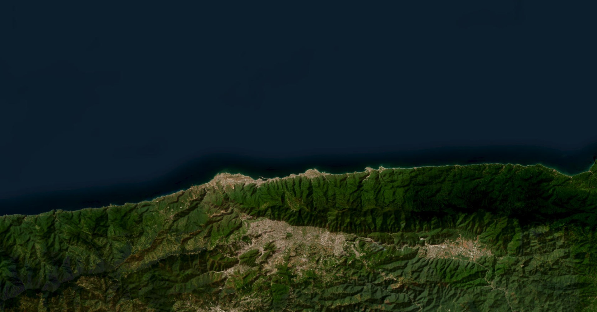
North America — Mexico and Central America Driving Peak Dry-Season Activity
North America accounts for 398 of the 820 named events and 139 of the 212 WARNINGs — the largest single regional concentration. The signal is split across three sub-stories:
- Mexico (24 WARNING fires). Chiapas continues to produce the heaviest exposure (e.g., Chilón, Chiapas – 12,500 people, $197M capital; Tumbalá – 13,200 people, $137M), with additional warnings across Campeche, Yucatán, and Nuevo León. A single Cadereyta Jiménez, Nuevo León event registers $744M in capital exposure against just 226 people — a reminder that capital exposure tracks built infrastructure, not just population density.
- Honduras (26 WARNING fires). A coherent late-dry-season front across Yoro, Olancho, El Paraíso, and the Atlántida coast, with one Santa Bárbara incident at 25,200 people, $285M capital.
- Guatemala (6 WARNING fires). Featured this week: Wildfire – Alta Verapaz and Quiché, Guatemala (WARNING), near Cobán, Ixcán, and Chicaman. Exposure model: 40,200 people, 8,930 households, $55.1M in infrastructure. This is the brief’s anchor event because it sits at the intersection of three things: peak dry-season activity in Central America, a forested-terrain fire with WUI proximity, and a multi-municipality footprint that resists clean political boundaries — exactly the kind of incident that benefits from automated assembly into a single named event rather than being scattered across district-level reports. Guatemala’s Petén region adds a string of additional perimeters along the Belize border (San Andrés, La Libertad, Melchor de Mencos).
- United States (70 WARNING fires). This is the broadest national footprint in the dataset. Active California WARNINGs in Ventura, Kern, and Riverside counties are the headline, but the heavier capital exposure sits in the Southeast and South-Central: Randolph County, NC ($1.98B), Greene County, MO ($1.54B), Broward County, FL ($1.02B), Randall County, TX ($1.14B). The pattern remains the one we flagged in early May — a Southeast-led, transcontinental early-season picture, now joined by California.
- Belize and Mexico–Guatemala border add cross-border perimeters that span jurisdictions.
Europe — Russia’s Boreal Spring Is Producing the Largest Capital Exposures
Europe accounts for 122 named events and 24 WARNINGs, but it produces an outsized share of the highest-capital incidents because Russian regional centers carry significant built-infrastructure exposure:
- Cherepovetskiy Rayon, Vologda, Russia (WARNING) — 66,300 people, $6.32B capital
- Nizhniy Tagil, Sverdlovsk, Russia (WARNING) — 36,100 people, $5.57B capital
- Lipetsk, Russia (WARNING) — 39,600 people, $3.65B capital
- Sosnovskiy Rayon, Tambov; Bryansk; and Krasnoyarsk rounding out the regional picture
- Ukraine (9 WARNING fires) — including Krasnolymanskyi, Donetsk (5,550 people, $156M capital), continuing the Bryansk–Chernihiv–Sumy–Donetsk corridor pattern noted last week, with the wildfire layer overlapping active combat zones
- Sweden — a Luleå, Norrbotten WARNING (407 people, $220M capital) — a notably high-latitude European event
- Portugal — Sines, Setúbal (WARNING) — currently the only active wildfire WARNING in active_hazards across Europe’s Atlantic margin, and an early-season Iberian signal worth tracking against the European fire trajectory laid out last week
Africa — A Sahel-to-Equatorial Fire Belt, Densely Populated
Africa accounts for 118 named events and 16 WARNINGs, but the population-exposure totals are the largest of any continent because of the density of West and Central African landscapes:
- Guémon and Tonkpi, Montagnes, Côte d’Ivoire (WARNING) — 20,400 people, $72.0M capital at the largest reading, with multiple updates over the week showing the perimeter expanding
- Tonkpi, Montagnes, Côte d’Ivoire (WARNING) — separate event series, peaking at 15,100 people / $18.0M
- Johannesburg and West Rand, South Africa (WARNING) — 68,200 people, $989M capital
- Democratic Republic of the Congo — multiple Kasaï-region fires (Kamina at 92,200 people; Luilu/Kapanga at 57,300 people; Kasaï-Central at 51,200 people)
- Liberia, Sierra Leone, Mali, Sudan, Angola, Madagascar all producing additional named events
- Guntur, Andhra Pradesh, India (ADVISORY) — 231,000 people exposed — the single largest population-exposure wildfire in the dataset
South America — Venezuela’s High-Capital Coast
South America accounts for 51 named events and 8 WARNINGs, dominated by Venezuela:
- Carirubana, Falcón, Venezuela (WARNING) — 15,100 people, $4.64B capital
- Bolívar, Anzoátegui, Venezuela (WARNING) — 22,400 people, $2.35B capital
- Monagas, Venezuela (multiple WARNINGs) — 28,100 people, $2.00B in the largest record
- Brazil’s Serra and Vitoria, Espírito Santo (WARNING) — small population but $606M in capital
Oceania — Late Southern-Hemisphere Autumn Still Active
Oceania accounts for 81 named events and 18 WARNINGs — overwhelmingly Australia. The Northern Territory continues to host the largest perimeter footprints in the platform, dominated by tree-cover and grassland fuels. Active WARNINGs this week in Tasmania (Southern Midlands, Break O’Day), Western Australia (Manjimup, Nannup, Murray, Denmark, Broome), and Victoria Daly, Northern Territory.
Asia — Light But Notable
Asia accounts for only 26 named events and 2 WARNINGs — but the high-population Indian and Chinese events (Guntur 231,000 people; Heilongjiang Qiqihar/Heihe 55,000 people / $1.38B capital) are individually significant.
Why The 820 Number Matters
The headline number is not “820 fires this week.” The headline is that the platform turned 820 satellite-derived events into 820 incident records, each with land cover, intensity, WUI status, and exposure attached, distributed across all six fire-active continents, in 10 days, with no analyst stitching feeds by hand. Customers do not see “a thermal anomaly in Guatemala.” They see “40,200 people and $55.1M of exposure inside a 24-hour perimeter you can overlay against your facilities, your insured book, or your supply chain.”
That is the intelligence-layer story we wrote last week — and what this week’s data shows is that it scales.
Heat and Fire — A Visible Overlap
Seven Extreme Temperature WARNINGs are active during the window, and the geography overlaps the fire belt with near-perfect alignment:
- Extreme Heat – Mexico (WARNING) — SMN reports >45 °C in Sonora (east and south), Chihuahua (southwest), Durango (northwest), and Sinaloa (north), with 40–45 °C in Baja California (north). Sonora is the same state hosting peak Mexican wildfire activity this week — the most direct heat-fire correlation in the dataset.
- Extreme Heat – Northern and Central Africa (WARNING) — abnormally high temperatures forecast across northern Mali, northern Niger, Algeria, western Libya, central Cameroon, and the Central African Republic, overlapping the West African and Sahel fire-active zone.
- Extreme Heat – Central Asia (WARNING) — maximum temperatures 20–45 °C, up to 6 °C above average for three or more consecutive days across central and eastern Kazakhstan, southwestern Afghanistan, and western Pakistan.
- Extreme Heat – Cambodia (WARNING) — 36–38 °C across Oddor Meanchey, Banteay Meanchey, Battambang, Pursat, Kampong Thom, Ratanakiri, Stung Treng, Kratie, Kampong Speu, Tboung Khmum, Phnom Penh, Kandal, Prey Veng, Svay Rieng, and Takeo.
- Extreme Heat – Sri Lanka (WARNING) — heat index reaching “Caution level” in North-central and Eastern provinces and in Mannar, Vavuniya, and Monaragala districts.
- Extreme Heat – Southwestern Madagascar (WARNING) — overlapping a country also producing named fire events.
- Extreme Cold – Peru (WARNING) — counterpoint to the heat belt: SENAMHI reports a moderate-to-significant nighttime temperature drop in the northern and southern highlands, with wind gusts up to 45 km/h.
Heat and fire are not the same hazard, but they are correlated drivers — temperature, fuel moisture, and atmospheric instability move together. The fact that Sonora, the Sahel, Central Asia, and mainland Southeast Asia all carry Heat WARNINGs simultaneously is exactly the kind of cross-region signal that gets lost when peril feeds are siloed. The platform shows them together, on the same map, against the same asset model.
Storms: A Coherent Latin American Severe-Weather Cluster
While wildfire is this week’s lead, an unusually coherent severe-weather pattern is producing seven active Storm WARNINGs across Latin America and the Caribbean plus high-exposure Severe Weather WARNINGs in Southeast Asia:
- Storms – Mexico (WARNING) — capital exposure: $438B
- Storms – Ecuador (WARNING) — $230B capital
- Storms – Dominican Republic (WARNING) — $195B capital
- Storms – Costa Rica (WARNING) — $140B capital
- Storms – Brazil (WARNING)
- Storms – Guyana (WARNING) — $8.07B capital
- High Wind – Mexico (WARNING) — $191B capital
- High Wind – Bolivia (WARNING) — $2.52B capital
In Southeast Asia, Severe Weather WARNINGs are active across Peninsular Malaysia ($770B capital), Eastern Malaysia ($97.7B), and Sri Lanka ($208B). Vietnam adds two sharply localized severe local storm events, both at WARNING:
- Severe Local Storm – SE of Lao Chi, Lào Cai, Vietnam (WARNING) — 51,700 people, 15,000 households, $85.4M capital (ADINet reporting on May 10–11). Preliminary ADINet reporting indicates ~484 individuals across 121 households directly affected on the ground. The larger of the two Vietnam events by people and capital.
- Severe Local Storm – SW of Dong Ha, Quảng Trị, Vietnam (WARNING) — 30,200 people, 8,770 households, $35.9M capital inside a 10-km buffer (May 16).
These are large-population, large-capital warning zones running in parallel to the wildfire belt — and visible in the same map view, against the same exposure model.
Volcanic Unrest: 12 Volcanoes At WARNING
The Pacific Ring of Fire and Mexico–Central America volcanic arc continue producing simultaneous unrest:
- Volcano – Popocatepetl, Mexico (WARNING)
- Volcano – Fuego, Guatemala (WARNING)
- Volcano – Santa Maria, Guatemala (WARNING)
- Volcano – Reventador, Ecuador (WARNING)
- Volcano – Aira (Sakurajima), Japan (WARNING)
- Volcano – Semeru, Indonesia (WARNING)
- Volcano – Ibu, Indonesia (WARNING)
- Volcano – Dukono, Indonesia (WARNING)
- Volcano – Mayon, Philippines (WARNING)
- Volcano – Taal, Philippines (WARNING)
- Volcano – Bezymianny, Russia (WARNING)
- Volcano – Central Bismarck Sea, Papua New Guinea (WARNING)
ADVISORY-level activity continues at Kilauea, Sabancaya, Kanlaon, and Purace. For aviation operators in Asia-Pacific and the Caribbean rim, Mayon, Semeru, Aira, and Popocatepetl remain the most operationally consequential — each sitting within or adjacent to dense air corridors.
Earthquake, Flood, and Disease
- South China M5.2 earthquake — 2 fatalities reported per state media. The only significant fatal seismic event of the period.
- Floods – Northwest Colombia (WARNING) — 29.4 million people and $640B in infrastructure inside the affected area model.
- Flood – Bolivia (WARNING) — active flood warning recorded during the period, the second confirmed flood WARNING in the dataset alongside Colombia.
- Biomedical WARNINGs:
- Dengue Fever – New Caledonia
- Dengue Fever – Samoa
- Dengue Outbreak – Tonga
- Measles Outbreak – Bangladesh
- Ebola – Kinshasa, Democratic Republic of Congo and Uganda
- Famine — 10-country footprint continues across Afghanistan, Haiti, Sudan, South Sudan, Somalia, Ethiopia, Yemen, DRC, Madagascar, and Northern Nigeria.
Combat and Civil Unrest
Four Combat WARNINGs are currently active:
- Combat (Airstrike) – Gaza City, Gaza Strip
- Combat – Lebanon (Response Support)
- Combat (Airstrike) – Zellaya, Lebanon
- Combat – Iran (Response Support)
Additional advisories track West Bank counter-terrorism operations and Erkay, Lebanon. The wider context — captured in news monitoring — includes Cuba’s warning over reported US drone operations, an NYT report on alleged Israeli covert military bases in Iraq, continued Ukraine drone activity, and a reported drone attack on a UAE nuclear plant. Civil-unrest tracking added Kenya fuel-price protests (4 fatalities), Khalistan protests in Oslo, the NYC transit strike, and a Samsung labor negotiation flagged as a global supply-chain risk.
What We’re Watching Next
- Atlantic hurricane season opens June 1. With 13 days to go, the question is whether the Latin American storm cluster currently producing WARNINGs across Mexico, Ecuador, Costa Rica, Dominican Republic, and Brazil is a preview of an early-active basin, or just a coincident pattern. We will be watching SST and steering-flow indicators in next week’s brief.
- Northern Hemisphere fire-season acceleration. Two weeks in, the dataset has gone from 1,352 24-hour perimeters at peak to a 10-day total of 820 named events with 212 WARNINGs. Whether Russian and Canadian boreal activity ramps further into June is the single largest hazard story to track over the next 4–8 weeks.
- Russia–Ukraine fire-conflict overlap. Multiple Bryansk-corridor and Donetsk-region fires continue to burn inside active combat geography. Operational implications for humanitarian access, ground truth, and damage attribution will compound as the season deepens.
- Asian monsoon onset. Severe Weather WARNINGs in Peninsular Malaysia, Eastern Malaysia, and Sri Lanka are leading indicators — the heavy-rainfall side of the Indian Ocean monsoon transition is approaching.
- Heat-fire correlation. With seven simultaneous Extreme Temperature WARNINGs already on the board — and Sonora, the Sahel, and Central Asia all overlapping fire-active geography — the question for the next 4–6 weeks is whether the African and Central Asian heat domes expand westward and northward, accelerating fire activity into the boreal latitudes.
- Volcanic continuity. 12 simultaneous volcano WARNINGs is above baseline. Watch Popocatepetl, Mayon, and Taal for any escalation in eruptive phase.
How DisasterAWARE Delivers This
This brief was produced from a single platform that fuses, in one operational view:
- NASA FIRMS thermal detections, assembled into named wildfire incidents with lifecycle tracking
- Land-cover, FRP, and WUI attribution on every perimeter
- Automated population and capital exposure for every named incident
- Side-by-side correlation with every other hazard category — volcano, earthquake, severe weather, storm, flood, combat, biomedical, civil unrest — against the same asset model
- Real-time alerting on intersections between hazards and any defined facility, supply route, or insured asset
For organizations whose risk does not respect a single peril, a single hemisphere, or a single fire season, this is the difference between counting hotspots and seeing the operating picture.
See this week’s events in real time:
More from DisasterAWARE
This brief covers verified hazard activity from May 9 to May 19, 2026. Wildfire totals reflect 820 named events derived from NASA FIRMS thermal detections during the 10-day window, of which 212 are currently at WARNING severity. Each named event is a real heat signature observed from a NASA satellite — ground corroboration follows in the days after detection. Active hazard counts reflect the DisasterAWARE V2 active-hazards feed as of 2026-05-19. Data sources: DisasterAWARE platform (NASA FIRMS-derived wildfire incidents, USGS, JTWC, NWS, VAAC network, ASEAN ADINet, WHO, UNICEF, UN-WFP, FEWS NET, IPC). Analysis powered by DisasterAWARE.


-min.png)


.png)


.png)


