


DisasterAWARE Weekly Intelligence Brief — October 23 to November 2, 2026
For ten days the desert Southwest had the weather of a Gulf Coast spring. Between October 23 and November 2 the National Weather Service offices in El Paso, Albuquerque, Midland, Flagstaff, Phoenix, Tucson and Las Vegas issued 120 flash flood warnings between them, 15 tornado warnings went out nationwide, 11 of them in New Mexico, West Texas and the Texas Panhandle, and Albuquerque and El Paso alone issued 140 severe thunderstorm warnings. On the ground, NWS storm reports from six states record 204 flash-flood and flood reports, 10 tornado reports and three people swept away and killed in New Mexico, a confirmed EF1 tornado in the city of Santa Fe, an estimated 1,500 homes and buildings affected by the San Juan River at Farmington, 150 to 200 homes flooded at Rimrock and Lake Montezuma in Arizona, and swift-water rescues from Las Vegas to Tucson. For October as a whole, the NWS issued 416 flash flood warnings nationwide, against 156 in October 2025, and the seven Southwest offices issued 27 tornado warnings in a month that has never produced more than three in any year since 2020.
Half a world away, India's Andhra Pradesh coast took two cyclone landfalls in six days: Arnab on October 28 and Murasu, a Category 2 equivalent at landfall, in the early hours of November 3 with 11.9 million people inside its forecast wind footprint. This brief covers both, with Typhoon In-fa still at sea in the western Pacific.
How to read every number in this brief. We keep two kinds of numbers apart. Alert-tier numbers are products the National Weather Service or another agency issued (warnings, advisories, watches): forecasts with a defined area and, in DisasterAWARE, an estimated population inside that footprint. Observed-tier numbers are reports of something that happened: NWS Local Storm Reports, damage surveys, river gauges and official statements. A warning is not an event, and a footprint population is not a count of people affected. We label each figure by its tier.
Observed tier (reports, surveys and measurements, October 23 to November 2):
Alert tier (NWS products issued, complete record via the Iowa Environmental Mesonet VTEC archive):
Explore the map. It opens on the Four Corners, El Paso and Phoenix, and every layer is labelled by tier. Observed: the 55 NOAA river gauges that reached flood stage, coloured by category (dark red major, red moderate, amber minor), with each gauge's peak, thresholds and historic crests in its popup; the 11 confirmed tornado reports with the Santa Fe path drawn; and the three flood deaths. Modeled: the NWS's experimental flood-depth bands at the stage each of 8 gauges reached (1-foot steps, from the Rio Puerco at Bernardo to the San Juan at Farmington and Pagosa Springs), and the National Water Model's 9,449 stream reaches that peaked at a 20-year-or-rarer flow in the past 14 days (blue to purple as the flow gets rarer). Alert: the actual polygons of all 170 flash flood and flood warnings and all 15 tornado warnings issued in the window. Off by default: the 205 severe thunderstorm warning polygons, 127 rain reports of 2 inches or more, the 202 individual flood reports and 14 hail reports. Zoom out to the Bay of Bengal for the JTWC tracks and forecast cones of Cyclones Arnab and Murasu, coloured by category, and to the Pacific for Typhoon In-fa.
A slow-moving upper-level low sat over the Southwest from October 22, drawing subtropical moisture north, and what made it dangerous was that it stayed. Round after round of thunderstorms fell on northern New Mexico, the Four Corners and the Rio Grande valley, then on West Texas, then, on October 30 to November 1, on Nevada and central Arizona. The result was a stacking of hazards the region sees in monsoon season, not in the last week of October: river flooding on the San Juan, the Animas and the Rio Grande tributaries, flash floods in the arroyos of Albuquerque, Santa Fe and El Paso, and tornadoes on three days.
New Mexico, October 23 to 26. The San Juan River flooded Farmington on October 23. NWS Albuquerque's storm report that morning estimated as many as 1,500 homes and buildings impacted, with multiple evacuations under way, and the West Chaco bridge over the Animas in Aztec was overtopped later that morning; the next day the Highway 64 bridge at Shiprock closed as the river passed 21 feet. In the Rio Grande valley, Interstate 40 closed in both directions near Laguna Pueblo on October 24 as the Rio San Jose crossed it, and the Sky City Casino's first floor flooded, sending guests to the second floor. On October 25 to 26 the Rio Puerco took out a bridge near Belen and closed US 60 at Bernardo, where fifteen people needed water rescue and, in the early hours of October 26, a woman was swept away in a truck and found that afternoon. A levee breach in Socorro County forced the evacuation of the Escondida and Pueblito communities on the night of October 27. Earlier, late on the night of October 23, a man was swept away in a truck at a low-water crossing south of Pagosa Junction in northern New Mexico, and on the night of October 25 a car with three people was swept from a crossing north of Agua Fria near Santa Fe: the man and an infant were rescued, the woman died. Those are the three deaths in the NWS record. The Associated Press, reporting on October 27, counted "at least two" in New Mexico and quoted Governor Michelle Lujan Grisham estimating the state's damage at as much as $300 million. A federal emergency declaration (EM-3660-NM) dated October 26 covers Cibola, Rio Arriba, Sandoval and San Juan counties and five tribal areas, with 75 percent federal funding for emergency protective measures. San Juan County's spokesperson told AP that 200 to 300 people had been rescued in the county.
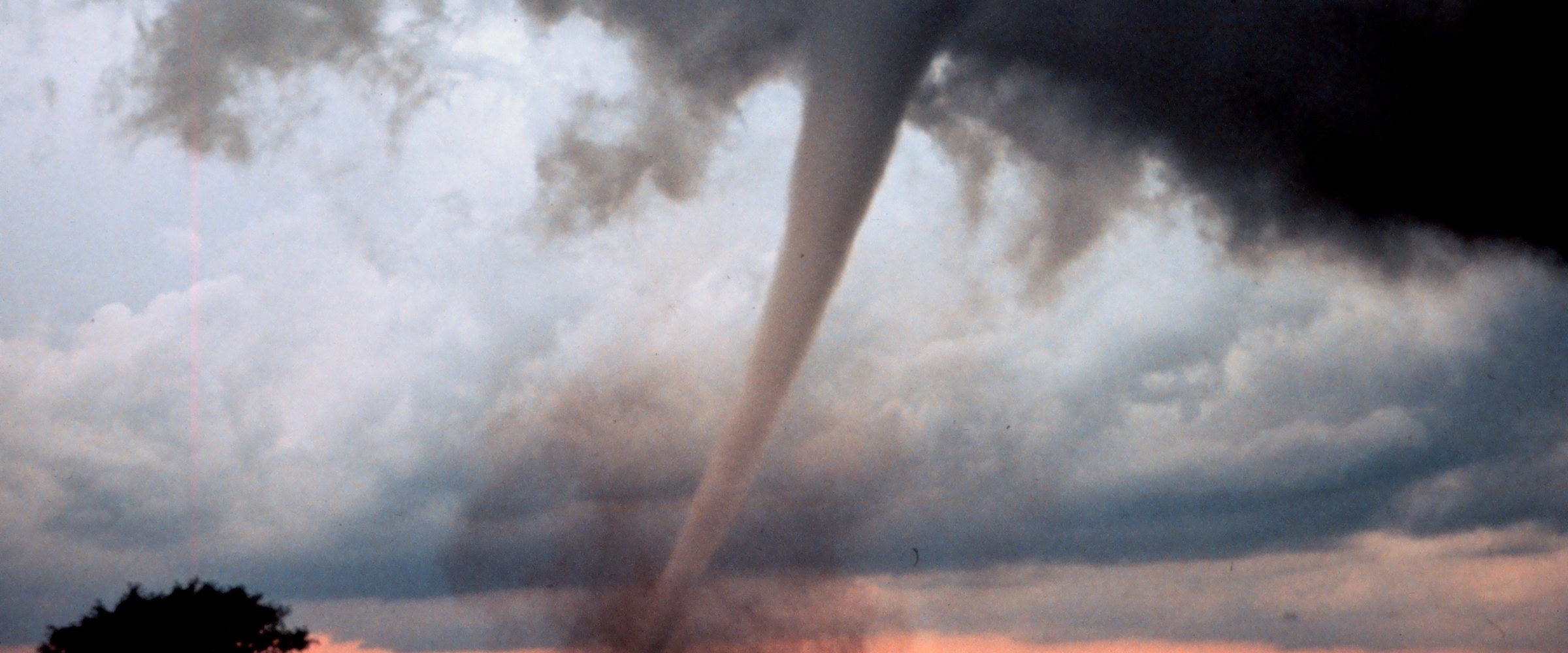
The Santa Fe tornado, October 24. At 7:00 PM on Saturday evening a tornado formed in the Via Caballero neighbourhood just north of I-25 and ran 1.48 miles north to the College of Santa Fe campus, lifting at 7:08 PM. NWS Albuquerque's survey, completed October 26, rated it EF1 with peak winds of 110 mph and a maximum width of 100 yards: broken power poles, uprooted trees, ten homes damaged, one of them with most of its roof removed and a wall collapsed, no injuries. Local reporting says the city had not seen a tornado inside its limits since 1971. It was one of four tornadoes reported in New Mexico that weekend: near Alto on the evening of October 24 (minor damage to a house, a garage door blown in), and two brief ones over open land on October 25, near Table Mesa and northeast of McAlister, both with no damage. Reported tornadoes are observed; the warnings around them are alerts, and the Santa Fe timeline shows how tight the margin was. NWS Albuquerque's severe thunderstorm warning for the city went out at 6:58 PM, two minutes before the tornado formed; its tornado warning was issued at 7:01 PM, one minute after, and the tornado lifted at 7:08 PM (IEM archive of the warning polygons, checked against the survey's start point). El Paso had issued the week's first two tornado warnings on October 23 for southwestern New Mexico, including Sierra County, and Albuquerque's October 25 warning for Quay County covered the McAlister tornado.
El Paso and West Texas, October 23 to 30. Golf-ball hail on October 23 ruined a golf course's greens south of Fort Bliss and covered a Costco parking lot. Flash floods on the night of October 25 to 26 put water into homes and apartments in east El Paso and left vehicles stuck in the Montana Vista and Sparks areas; on the evening of October 26, nine homes in Horizon City were evacuated for a suspected dam breach. In the Permian Basin, Midland issued 19 flash flood warnings in the window and its storm reports on October 30 record water over Interstate 20, Highway 158 and streets across Stanton. Near Uvalde on the evening of October 29, NWS Austin/San Antonio confirmed a tornado from video, over open ranch land, with EF0 damage to vegetation.
Las Vegas, October 30. The system's push west brought the valley its own afternoon: hail to 1.5 inches (ping-pong balls) near Sahara and Maryland Parkway, and six swift-water rescues logged by NWS Las Vegas between 1:15 and 1:47 PM, in Henderson, east of downtown and in North Las Vegas, plus road closures at Lake Mead, Overton and Laughlin. The flash flood warning NWS Las Vegas issued at 12:43 PM for the Arizona-Nevada border reached a footprint of 78,600 people in DisasterAWARE's record. Four adults were hurt when lightning struck near a bus stop in El Mirage, Arizona that morning.
Arizona, October 31 to November 2. Phoenix came first: on the evening of October 30, local time, six people were pulled from four vehicles in a wash near Paradise Valley and Camelback Road ran with water across two lanes. Then Sunday, November 1, was the worst single day of the week. Arizona logged 44 flash-flood and flood reports that day by local time, most of them from the Flagstaff and Tucson offices: Interstate 17 closed at Munds Park, where an estimated 100 properties flooded, with further closures northbound near Rimrock and southbound near Flagstaff; Oak Creek flooded Sedona and Cornville, and Lake Montezuma flooded too, with Yavapai County officials reporting floodwaters overrunning homes in Lake Montezuma and the Flagstaff office's storm report estimating 150 to 200 homes flooded in Rimrock and Lake Montezuma by Sunday night; the state Department of Public Safety rescued 18 people from the Oak Creek area, per Arizona's Family; Camp Verde ordered everyone near the Verde River, West Clear Creek and Wet Beaver Creek out; Highway 73 closed on the White Mountain Apache lands and the Show Low area saw widespread flooding; and Tucson's fire crews ran swift-water rescue after swift-water rescue across the city from 10:20 AM, with Sabino Canyon in minor flood and the Nogales Wash at bankfull. By Monday morning, November 2, Arizona's Family listed "GO" evacuation orders still in force at Winslow, on the San Carlos Apache and White Mountain Apache lands, at Cornville, Cottonwood, Camp Verde and Queen Valley, with Clifton's overnight evacuation lifted at 5 AM. That afternoon Governor Katie Hobbs declared a state of emergency for parts of Apache, Coconino, Gila, Greenlee, Navajo, Pinal and Yavapai counties and the Hopi, Navajo, San Carlos Apache, San Juan Southern Paiute and White Mountain Apache nations, with $200,000 in state funds, three days after a separate emergency for Navajo and Coconino counties over the three tornadoes of October 20 to 22 (an EF1 with 110 mph winds that ran more than nine miles through Heber-Overgaard, a 105 mph tornado near Prescott on October 21, and a third north of Bellemont the same morning). Arizona may also have its own flood deaths: Flagstaff police reported a 73-year-old swept away on the evening of November 1 and found dead the next day, and a second body found in a stormwater drainage on November 2, per KNAU and Arizona's Family. Neither is in the NWS storm-report record yet, so our observed-tier count stays at three.
Colorado and Utah. The first days of the window were the Four Corners' worst: the Park Creek bridge on US 160 washed away near South Fork on the night of October 22 to 23 with evacuations from Wolf Creek Ranch to Fun Valley, a house on the Rio Blanco near Pagosa Springs was swept away, and the Paria River in Utah ran three flood waves, the largest 3,150 cubic feet per second early on October 23. AP reported that in Bluff, Utah, a town of 250, 17 homes and five businesses had flooded by October 27.
The rivers, by the gauges. NOAA's river gauges turn the storm reports into a measured record. Of the gauges in Arizona, New Mexico, Colorado, Utah, Nevada and West Texas that carry NWS flood categories, 20 reached major flood stage between October 22 and November 2, 12 reached moderate and 23 minor (observed tier: NOAA NWPS provisional readings, checked against each site's published thresholds). The first wave was the San Juan basin's: the San Juan at Farmington peaked at 14.07 feet late on the morning of October 23, two feet above major stage and above the 12.3-foot crest of September 1909 that tops NOAA's list for the site; at Shiprock it reached 21.22 feet the next morning against a listed high of 14.5; the Rio Chama above Abiquiu hit 13.64 feet (major; listed high 10.76) and the South Fork Rio Grande at South Fork 9.03 feet (major, second only to 1911). The Rio Puerco near Bernardo, where the woman died on October 26, crested at 24.29 feet late that afternoon, moderate stage, second only to the 27.9-foot crest of September 1941 in NOAA's list for the site. The second wave was Arizona's: on November 1 and 2 the Verde River near Camp Verde reached 24.65 feet (major; listed high 19.67 in March 2023), Oak Creek at Page Springs near Cornville 21.2 feet (major; 19.15 in 1993), Wet Beaver Creek near Rimrock 13.56 feet (major), the Little Colorado near Winslow 25.29 feet (major; 22.12 in 2023), the San Carlos River above Peridot 16.59 feet (major) and the Gila near Solomon 26.86 feet (major; 20.8 in October 1983). In all, 18 gauges peaked above every historic crest NOAA lists for them. Two more (Carrizo Creek near Show Low and the Little Colorado above Lyman Lake) report values so far above their own thresholds that we treat them as suspect until NOAA reviews them. The map draws the NWS's experimental modeled inundation for eight of these gauges at the stage they reached, in one-foot bands.
See every warning next to what it verified
DisasterAWARE puts issued warnings and observed impacts on one map — with the people, infrastructure and assets inside each footprint.
Did the warnings match the water? We took the time and place of each major impact from the NWS storm reports and checked which storm-based warning polygons were in force there at that moment, using the Iowa Environmental Mesonet's archive. For the big, slow floods the answer is yes, and in the right order. Farmington on October 23 sat inside an Albuquerque river flood warning issued at 8 PM the night before, on top of a flood advisory issued that same morning, October 22. The Sky City Casino and the I-40 closure at Laguna on October 24 were inside both an areal flood warning from October 23 and a flash flood warning issued four hours earlier. Bernardo's rescues and its death on October 26 were inside the Rio Puerco river flood warning issued on the evening of October 24. Henderson's swift-water rescues on October 30 fell inside a Las Vegas flash flood warning issued 32 minutes before the first one; the Paradise Valley rescues on the evening of October 30 were inside a Phoenix flash flood warning issued an hour before; Rimrock's flooded homes on November 1 were inside a Flagstaff flood warning from that morning.
The two other deaths are the exception, and the lesson. The truck swept from a low-water crossing south of Pagosa Junction late on October 23, and the car swept from a crossing north of Agua Fria on the night of October 25, were both outside every storm-based warning polygon in force at the time the NWS recorded for them (the nearest flood warning to the Agua Fria crossing was about 10 miles away). A county-wide flash flood watch may well have been in effect; watches are not polygon products and we did not check them. Both reports carry approximate times. But on the record as it stands, two of this week's three deaths happened at crossings no warning polygon covered, in a week when the Albuquerque office issued 25 flash flood warnings and 74 severe thunderstorm warnings. The volume of warnings is not the problem; low-water crossings at night are, and no warning product draws a polygon around every arroyo.
For tornadoes the picture is thinner. Fifteen tornado warnings in the window, ten tornado reports, one survey published. The Santa Fe tornado is the clearest example of the gap between the two tiers: the tornado warning came one minute after it formed, it did EF1 damage in a city that had no tornado in living memory, and it was rated two days later. DisasterAWARE's own feed carried 8 of the 15 tornado warnings, and not the Santa Fe one, which is one reason this brief counts from the complete archive. On the map, the warnings (alert) and the 11 reports (observed) are separate layers.
A note on the platform's numbers. DisasterAWARE's feed carried 107 of these US products with footprint populations; the complete NWS record is larger because the feed folds re-issued and continued products into one hazard. We use our records for exposure and the complete record for counts, and we say which is which.
Cyclone Arnab (observed, landfall October 28). Arnab crossed the Andhra Pradesh coast near Narsapur on the morning of October 28. In DisasterAWARE's record, built from Joint Typhoon Warning Center advisories, the storm was over land near the coast with sustained winds of 102 km/h (63 mph) at the 09:00 UTC advisory that day; the India Meteorological Department had tracked it as a very severe cyclonic storm with gusts to 150 km/h before landfall. The Associated Press reported at least three deaths in Andhra Pradesh on the day of landfall and tens of thousands evacuated; by October 30 Chief Minister Chandrababu Naidu put the state's toll at seven. The worse toll came later and inland: rain from the weakening system set off landslides in Odisha's Kandhamal and Ganjam districts on the night of October 29 to 30, and by November 1 Odisha's toll stood at six with ten still missing, per Indian press reports citing state officials, with more than 23,000 people in relief camps as of October 30. The state announced a relief package on November 1, with a central assessment team due in Odisha the next day.
Cyclone Murasu (observed, landfall November 3). Murasu formed over the Bay of Bengal on November 1 and came ashore on the south Andhra coast near Ongole in the early hours of November 3: the landfall process began around 1 AM local time, and the IMD put the centre's crossing between 3:30 and 5:30 AM. At the 03:00 UTC JTWC advisory, with the centre 15 km from the coast, DisasterAWARE recorded sustained winds of 157 km/h (98 mph), gusts to 194 km/h, a Category 2 equivalent, and estimated 11.9 million people, 2.90 million households and $55.6 billion of infrastructure inside the forecast area exposed to moderate to severe damaging winds (alert tier: a footprint estimate, not a count of people affected). The IMD forecast a storm surge of 1.0 to 1.5 metres above the astronomical tide for low-lying parts of south coastal Andhra Pradesh. Preparations were larger than for Arnab: red alerts for the south coastal districts, 11 NDRF and 13 SDRF teams, 725 medical teams and 171 relief camps (PTI, November 3), schools closed in several districts and in Chennai, and at least 19 domestic flights cancelled at Vijayawada, Tirupati and Visakhapatnam. First reports on November 3 put the toll at two deaths, 12,230 people in cyclone shelters, crops damaged across 52,459 hectares in 15 districts (Krishna, Bapatla and Nandyal worst hit) and around 2,750 electricity poles down, with a preliminary damage estimate of Rs 344 crore. These are first-day figures and will change. Readers in the region can check the live status for Chennai.
Typhoon In-fa (alert). In-fa passed near or over the sparsely populated northern islands of the Northern Marianas, well north of Saipan, on October 30 to 31, the fifth typhoon to affect the Marianas this year by AccuWeather's count, after Super Typhoon Champi's Category 5 peak and its pass over Taiwan and southern Japan on October 22 to 24. At the November 3 03:00 UTC advisory In-fa was a Category 1 equivalent (130 km/h sustained), heading west at 11 km/h and forecast to strengthen, with no major landmass in its 48 to 72 hour track. The Japan Meteorological Agency declared Champi extratropical over the East China Sea on October 25, and its remnant crossed Kyushu the next day.
Every product in this brief, from a 30-minute severe thunderstorm warning for one New Mexico county to a cyclone forecast with 11.9 million people in its path, arrives in DisasterAWARE as a geocoded record with its footprint, the population, households and infrastructure inside it, and the issuing agency's own text. Observed impacts, from NWS storm reports to damage surveys, sit alongside the alerts rather than being mixed into them. For operations teams that means a site screen that answers two questions separately: is my facility inside an active warning, and has anything been reported there? The live flood board and the live tornado board on Explore show the same feed for the public, by city: Albuquerque, El Paso, Phoenix, Tucson and Las Vegas all had live warnings this week.
Was there a tornado in Santa Fe in October 2026?
Yes. The National Weather Service in Albuquerque confirmed an EF1 tornado with peak winds of 110 mph in the city of Santa Fe on the evening of October 24, 2026. It travelled 1.48 miles from the Via Caballero neighbourhood to the College of Santa Fe campus, damaged ten homes and injured no one.
How many people died in the New Mexico floods?
NWS Albuquerque's storm reports record three deaths between October 23 and 26, 2026, each a person swept away in a vehicle at a flooded crossing: south of Pagosa Junction in Rio Arriba County, north of Agua Fria near Santa Fe, and at Bernardo in Socorro County. The Associated Press reported "at least two" on October 27. Official state totals may differ.
How unusual were 416 flash flood warnings in October?
Very. The NWS issued 416 flash flood warnings nationwide in October 2026, against 156 in October 2025 and between 74 and 245 in each October from 2020 to 2024, per the Iowa Environmental Mesonet's archive of NWS products. The seven Southwest offices issued 149 of them; their previous October high in that period was 68, in 2022.
What is the difference between a warning and a flood report in this brief?
A warning is an alert-tier product: the NWS's forecast that flooding is imminent or occurring in a defined area. A flood report is observed-tier: a Local Storm Report of water over a road, a rescue, a flooded home, filed by spotters, emergency managers and officials. We count and map them separately.
Did Cyclone Murasu hit the same place as Cyclone Arnab?
Nearly. Arnab crossed the Andhra Pradesh coast near Narsapur on October 28, 2026; Murasu came ashore about 200 km further south near Ongole in the early hours of November 3, with its forecast wind footprint overlapping the districts Arnab had already soaked.
Sources: NWS warnings and warning polygons via the Iowa Environmental Mesonet VTEC archive; NWS Local Storm Reports via IEM; NOAA National Water Prediction Service gauge observations, flood categories and historic crests (provisional); NWS stage-based categorical flood inundation maps (CatFIM, experimental); NOAA National Water Model past-14-day high-flow analysis; NWS Albuquerque Public Information Statements (damage survey of October 26, 2026); FEMA declaration EM-3660-NM; Associated Press via NBC News (October 27); Arizona's Family (October 30, November 1 and November 2) and KNAU (November 2); Joint Typhoon Warning Center advisories as recorded in DisasterAWARE; India Meteorological Department bulletins and Indian press as cited (The Hindu, India Today, Times of India, Deccan Herald, TBS News); Pan American Health Organization natural hazards monitoring (October 29); AccuWeather and Weathernews on Typhoon In-fa. Banner: NASA Worldview, Suomi NPP VIIRS true colour, October 25, 2026. Analysis and map by DisasterAWARE.



Decision-ready intelligence for understanding what's happening, what is impacted, and what to do next. Global hazard, severe weather, catastrophe, and physical risk intelligence trusted by governments, enterprises, insurers, humanitarian organizations, and technology platforms worldwide.
Request DemoContact Us

