


DisasterAWARE Weekly Intelligence Brief — November 1 to 12, 2026
In the first week of November, tornadoes touched down on both sides of the equator, and the warnings looked nothing alike. In the southern Plains and the ArkLaTex, National Weather Service surveys confirmed six tornadoes overnight on November 2 to 3 and during November 3, three rated EF0 and three EF1, with no deaths or injuries. Three came overnight in Oklahoma and Arkansas; three came in daylight in Louisiana and Missouri under only a Marginal risk from the Storm Prediction Center. None was inside a tornado warning polygon when it touched down: two had no warning of any kind, and the rest were covered by a tornado warning only in their final minutes or after they had lifted. In southern Brazil, at least six tornadoes were confirmed between November 2 and 7, one of them through the airport at Chapecó, and hail unroofed about 1,500 homes in Bento Gonçalves. Five of the tornadoes fell inside red, highest-level alerts from INMET, the national meteorological institute, sent 12 to 22 hours ahead: three under an alert that was never cancelled, two under one INMET later cancelled at a time we could not establish. Four people died in Santa Catarina and Rio Grande do Sul, none of them in a confirmed tornado.
These are not like-for-like warnings, and this brief does not treat them as such. A US tornado warning is a storm-scale product: a polygon a few counties across, issued minutes ahead, for a tornado that radar indicates or a spotter has seen. An INMET red alert is a regional forecast: a polygon covering parts of three states, issued the day before, for a day of storms capable of winds above 100 km/h. Brazil has no national storm-scale tornado warning; state civil-defence agencies send short-term storm alerts. The comparison that matters is the one we make every week: at the time and place of each impact, what warning was in force, and what did it tell people to expect?
How to read every number in this brief. Alert-tier numbers are products an agency issued (warnings, watches, alerts, outlooks): a forecast with a defined area and, in DisasterAWARE, an estimated population inside that footprint. Observed-tier numbers are measurements and reports of what happened: damage surveys, storm reports, station readings, civil defence counts. A tornado warning is not a tornado, and we never count one as such.
United States, alert tier (NWS products issued November 2 12:00 UTC to November 5 12:00 UTC in the south-central US, via the Iowa Environmental Mesonet VTEC archive):
United States, observed tier (NWS damage surveys and Local Storm Reports):
Brazil, alert tier (INMET CAP alerts):
Brazil, observed tier (civil defence, Simepar, INMET stations, as reported):
DisasterAWARE record: 227 active and 1,670 expired actual-event hazard records in the November 2 to 12 window after the weekly filter, with 11,851 Enterprise products attached.
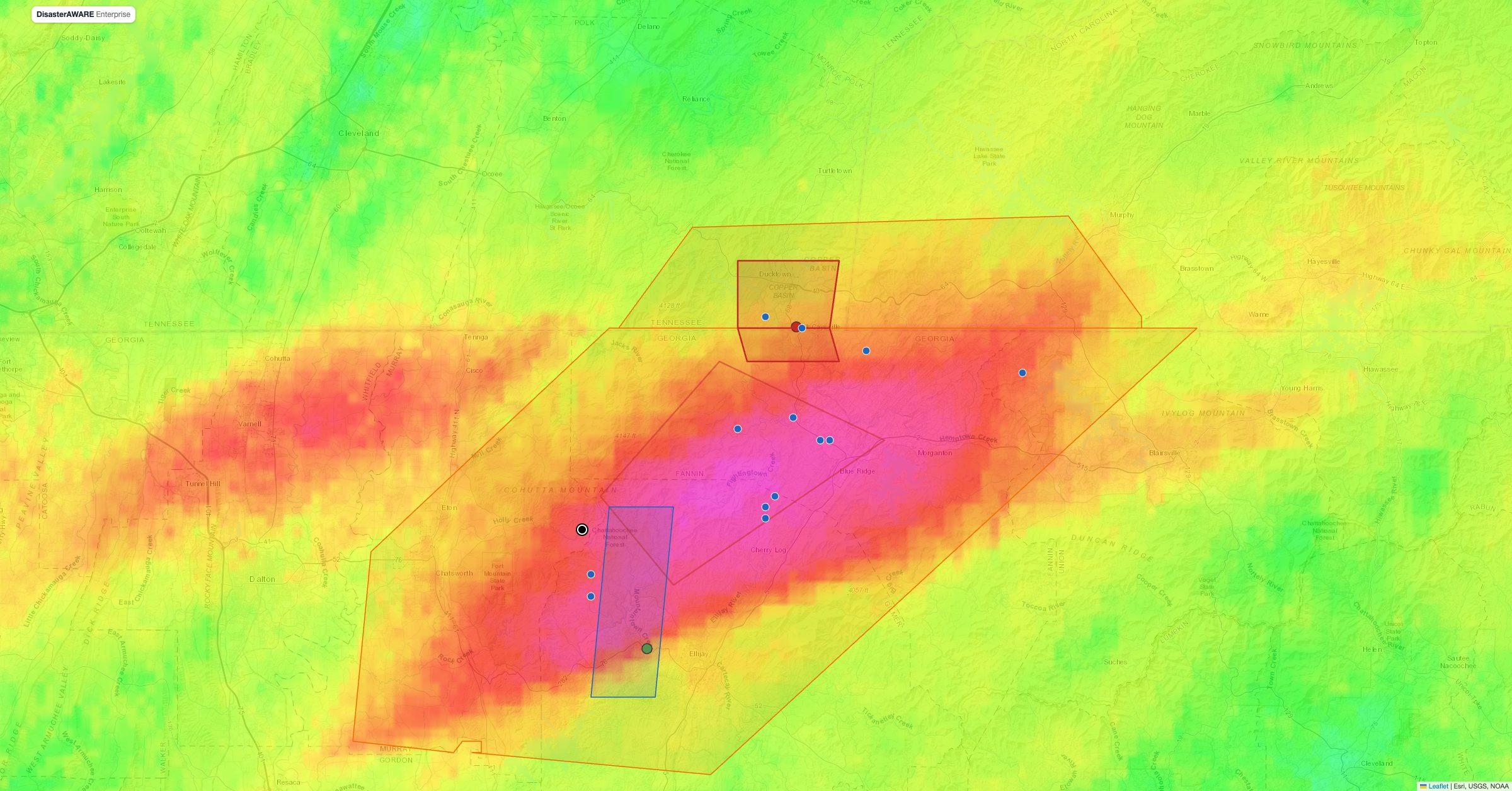
The map replays both outbreaks on a single UTC clock from November 1 to 7. Drag the slider or press Play: in the US, tornado and severe thunderstorm warnings appear when they were issued and change shape with every update, storm reports appear when they were filed, and each surveyed tornado track draws in at its start time over a NEXRAD radar replay. In Brazil, INMET alerts appear as they came into force, coloured yellow, orange and red, and impacts, tornadoes and hail damage pin to their municipalities as they happened. The panel on the left keeps a running count for each country and a warned-vs-observed table: click any row to fly to that tornado. Buttons at the top switch between both countries, the US alone and Brazil alone.
Explore the map. Radar, warnings, watches, survey tracks, storm reports, hail, INMET alerts, Brazilian impacts and station gusts are on by default. Ten more layers are off so the picture stays readable. Open the layer switcher at the top right and turn on:
Every feature has a hover label and a click popup naming its source and tier. Deep links work: #t=2026-11-04T13:40Z jumps the clock to the Chapecó tornado, #v=br opens on Brazil, #layers=goes,rot,mesh turns layers on.
The setup was real but modest. SPC's Day 1 outlook for November 2 peaked at an Enhanced risk with a 10% tornado probability over parts of Oklahoma at midday; by the 20:00 UTC update, kept in the 01:00 UTC update that was in force when the overnight tornadoes formed, the Talala and Adair areas were in a Slight risk with a 5% tornado probability and Cedarville in a Slight risk with 2%. SPC issued tornado watch #703 for northeast Oklahoma, northwest Arkansas and southwest Missouri at 01:35 UTC on November 3. The storms that followed overnight produced the night's three Oklahoma and Arkansas tornadoes. For the daytime of November 3, when the line reached Louisiana and Missouri, the outlook was only Marginal, a 2% tornado probability, and no watch was in effect.
What the surveys found. NWS Tulsa, Shreveport and Kansas City/Pleasant Hill confirmed six tornadoes:
No one was killed or injured. The paths ran from 1.05 to 3.38 miles, about 15 miles in total.
Radar saw more than happened. NWS Shreveport found no rateable damage under two tornado debris signatures, near Bert Kouns Road in Shreveport and near Belcher, and NWS Birmingham found none under two signatures in Bibb and Chilton counties, Alabama on November 4. Both offices attribute them to weaker, sub-tornadic circulations lofting light debris (leaves and pine needles at Shreveport, leaves and small branches at Birmingham); Shreveport adds that drought-stressed trees shed easily. A debris signature in autumn is not proof of a tornado.
See every warning next to what it verified
DisasterAWARE puts issued warnings and observed impacts on one map — with the people, households and infrastructure inside each footprint, in the US, Brazil and everywhere else we ingest.
We compared each surveyed track, as a straight line from start to end, with every tornado and severe thunderstorm warning polygon, including every update. None of the six tornadoes was inside a tornado warning polygon when it touched down.
That is a hard kind of tornado to warn for, not a failure of one office. All six were brief and weak; three formed at night and the Louisiana pair came from or just ahead of a squall line, the kind of tornado that typically gives little lead time. Several had severe thunderstorm warnings around them, and nine of the event's 66 severe thunderstorm warnings carried a "tornado possible" tag. The exposure was real all the same: the largest tornado warning of the event, Shreveport's at 16:55 UTC for Lafayette County, Arkansas and Bossier Parish, Louisiana, held an estimated 137,000 people, 55,000 households and $18.4 billion of infrastructure in DisasterAWARE. That is the population inside the warned area, not people affected.
Is a November tornado unusual? No. In the SPC tornado database, Louisiana averaged 4.2 November tornadoes a year from 1996 to 2025 and had at least one in 21 of those 30 Novembers; Oklahoma averaged 2.9 and Arkansas 3.3. November opens the Gulf Coast's secondary tornado season. Shreveport's seven tornado warnings so far this November rank sixth of 19 Novembers since 2008 against a record 30 in 2022. The outlier is North Carolina: NWS Raleigh's three tornado warnings on November 6 already tie for third of 19 Novembers in its record (with 2011), and no tornado had been confirmed from them as of November 18.
Maringá, November 2. In the early hours of November 2 a tornado crossed Maringá in northern Paraná. Simepar, the state's meteorological service, rated it an F2 on the Fujita scale after a field survey, with estimated winds of 180 to 253 km/h. Industrial sheds collapsed and the city issued a municipal decree. Copel, the state utility, reported about 85,000 to 86,000 customers without power in Maringá at the peak and later said it had restored about 88,000. It remains the only rated tornado of the week in Brazil.
Chapecó and Xanxerê, November 4. At about 10:30 BRT (13:30 UTC), a tornado struck Chapecó's Serafim Enoss Bertaso Airport in western Santa Catarina, tearing off part of the metal structure at the terminal entrance, breaking glass, damaging hangars and, according to EFE, moving a parked aircraft. Defesa Civil SC confirmed it as a tornado from radar rotation and a debris signature. Flights were suspended at least through November 6. About 18 minutes later, at 10:48 BRT, a second tornado touched down in Xanxerê, and the same line produced a third across Erval Grande, Itatiba do Sul and Barra do Rio Azul in northern Rio Grande do Sul, confirmed by Defesa Civil RS. Celesc, Santa Catarina's utility, had more than 200,000 customers without power at the peak, and about 2,400 homes were affected in Chapecó alone. No official rating had been published for any of the three as of November 18; Defesa Civil SC planned a drone survey.
Santo Augusto and Palmeira das Missões, November 7. A second system crossed northern Rio Grande do Sul at night. Defesa Civil RS confirmed tornadoes at Santo Augusto (early on November 7, about 01:18 BRT or 04:18 UTC according to Band), where about 50 homes lost their roofs, and Palmeira das Missões about half an hour later. A seventh tornado, at Rio Negrinho in northern Santa Catarina, is still under investigation.
None of the deaths was in a confirmed tornado. In Rio Negrinho, a 20-year-old fuel-station worker was killed on the afternoon of November 4 when the canopy of the fuel station where he worked, on the BR-280, collapsed in the wind; Defesa Civil is investigating whether a tornado struck there. In Xanxerê, a 46-year-old woman was electrocuted by a downed high-voltage line; the reports disagree on whether that was November 4 or 5. In Rio Grande do Sul, a 44-year-old motorcyclist was swept off a bridge in Sagrada Família and a 71-year-old woman was found on the bank of the Rio Carazinho in Cacique Doble; authorities are still investigating whether either death is linked to the storms.
The wider toll. Defesa Civil RS counted 70,491 people affected in 136 municipalities, 28 injured, 471 people staying with family or friends and 119 in public shelters by the morning of November 6, and a separate count of 26,965 people affected in 20 municipalities by the November 5 to 7 system. By November 5, the Santa Catarina state government reported, according to its bulletin as relayed by Atlas Público, 109 municipalities affected, 32 emergency decrees and 5,531 homes affected. In Rio Grande do Sul, MetSul's tally on the morning of November 5 was 6,496 homes hit, 2,140 of them unroofed and 10 destroyed: most damage was to roofs, not whole houses.
What the stations measured. The strongest gust on the INMET automatic network was 130 km/h at Caçador, Santa Catarina, in the hour ending 16:00 UTC on November 4. Passo Fundo, Rio Grande do Sul had the most rain, 238 mm from November 2 to 8, 159 mm of it on November 4. SBT News, citing INMET, reports a 126 km/h gust elsewhere in Chapecó; that station is missing from the feed we use, so we could not check it, and it is a station gust, not a tornado wind estimate.
The week's most widespread damage in Brazil came from hail and straight-line wind, not tornadoes. The map's hail layer sizes each place by the number of homes reported hit (damaged, unroofed or affected, in each agency's wording):
In the US, hail stayed small: the largest stone in the November 2 to 4 storms was 1.25 inches west of Norman, Oklahoma, and the largest on the map is the 1.75-inch report at Riley, Indiana on November 11. Radar estimates (MESH) reached about 2 inches on both days; they run larger than what reaches the ground and we do not quote them as hail size.
INMET's alerts are regional, so the test is different: was each tornado inside an alert in force, at what level, and how far ahead was it sent?
What that means. An INMET red alert told the whole of western Santa Catarina and northern Rio Grande do Sul, a day ahead, that November 4 would be dangerous. It could not say that a tornado would cross Chapecó's airport at 10:30 that morning. Closer in, state civil defence did warn: Defesa Civil SC says it issued a storm warning about 15 minutes before the Chapecó and Xanxerê tornadoes (SBT News), and Defesa Civil RS sent a red alert at 10:22 BRT to the area the Erval Grande tornado then crossed (Estadão). These were storm warnings, not tornado warnings, but they arrived before the tornadoes. In the US, the forecast for the daytime tornadoes was a Marginal risk, and tornado warning polygons reached the tracks only after touchdown, if at all. Both systems told the truth at their own scale. For someone who needs to know whether a site was in danger, each answers a different question, and the useful thing is to see both on one map.
In DisasterAWARE, the November 4 INMET-sourced extreme thunderstorm warning for southern Brazil held an estimated 11.7 million people, 4.23 million households and $369 billion of infrastructure inside its footprint, which again is the population warned, not affected. The Brazilian tornadoes appear in the platform as thunderstorm warnings and the PDC impact summary "Floods - Southern Brazil", not as separate tornado records.
Is this unusual for Brazil? Spring, September to November, is the peak of southern Brazil's severe-storm season, and 411 of 581 tornadoes recorded in Brazil from 1975 to 2018 were in the three southern states, according to a 2023 study from the State University of Ponta Grossa. MetSul, which counted six tornadoes in Santa Catarina and Rio Grande do Sul in four days, called that high for the regional climatology and said El Niño may make favourable set-ups more frequent, while stressing that El Niño does not cause tornadoes directly. Reporting has improved over time, so counts from different decades are not directly comparable.
North Carolina, November 6. NWS Wilmington and Raleigh issued four tornado warnings for Bladen, Sampson and Wayne counties between 18:00 and 19:29 UTC. No survey statement had confirmed a tornado as of November 18; vehicles were stuck in floodwater in Cary.
Mato Grosso do Sul. Storms brought emergency or calamity decrees to Santa Rita do Pardo, Glória de Dourados, Iguatemi and Vicentina and left more than 26,000 Energisa customers without power, according to local reports we could not fully verify.
Every product in this brief, from a tornado warning for one parish to an INMET red alert across three Brazilian states, arrives in DisasterAWARE as a geocoded record with its footprint, the population, households and infrastructure inside it, and the issuing agency's text. That is what lets a single map hold a US warning system and a Brazilian one side by side. The observed layer, damage surveys, storm reports, civil defence counts and station readings, is what this brief adds afterwards, and it is the layer that tells you which warnings verified and how much time they gave.
How many tornadoes hit Oklahoma, Arkansas, Louisiana and Missouri on November 2 to 3, 2026?
NWS damage surveys confirmed six: EF1s at Adair, Oklahoma, Cedarville, Arkansas and Clark, Missouri, and EF0s at Talala, Oklahoma, Belcher, Louisiana and in northwest De Soto Parish, Louisiana. No one was killed or injured. A seventh, an EF0, touched down near Riley, Indiana on November 11.
Were the November 3 tornadoes warned?
None was inside a tornado warning polygon when it touched down. Two had no warning of any kind; the others were covered by tornado warnings only in their last minutes or after they ended. All six were brief and weak, three of them at night, the kind of tornado that typically gives little lead time.
Did a tornado hit Chapecó airport?
Yes. Defesa Civil Santa Catarina confirmed that a tornado struck Chapecó's Serafim Enoss Bertaso Airport at about 10:30 local time on November 4, 2026, damaging the terminal and hangars; EFE reported that a parked aircraft was moved. No official rating had been published as of November 18.
Was the Maringá tornado an F2?
Simepar, Paraná's meteorological service, gave it an F2 rating on the Fujita scale after a field survey with estimated winds of 180 to 253 km/h. It is the only rated Brazilian tornado of the week.
Did tornadoes kill anyone in Brazil?
Four people died during the storms, but none in a confirmed tornado: a canopy collapse in high wind, an electrocution from a downed power line, and two deaths in Rio Grande do Sul whose link to the storms is still under investigation.
Sources: NWS tornado, severe thunderstorm and flash flood warnings and their polygon updates via the Iowa Environmental Mesonet VTEC archive; NWS Local Storm Reports via IEM; NWS damage surveys (Damage Assessment Toolkit and Public Information Statements from Tulsa, Shreveport, Kansas City/Pleasant Hill, Indianapolis and Birmingham); SPC watches, Day 1 outlooks and the SPC tornado database; NOAA NEXRAD composite radar and MRMS rotation and MESH products via IEM; GOES-East infrared via NASA GIBS; INMET CAP alerts and automatic stations (via WMO SYNOP); Simepar, Defesa Civil of Paraná, Santa Catarina and Rio Grande do Sul, Copel and Celesc as reported by Brasil de Fato, SBT News, MetSul, Agência Brasil, Cenário Energia, Correio/Estadão and local outlets; DisasterAWARE Enterprise warning records and exposure estimates. Exposure figures are estimates for the alert footprint at issuance, not damage counts.




Decision-ready intelligence for understanding what's happening, what is impacted, and what to do next. Global hazard, severe weather, catastrophe, and physical risk intelligence trusted by governments, enterprises, insurers, humanitarian organizations, and technology platforms worldwide.
Request DemoContact Us

